 geo.be Metadata Catalog
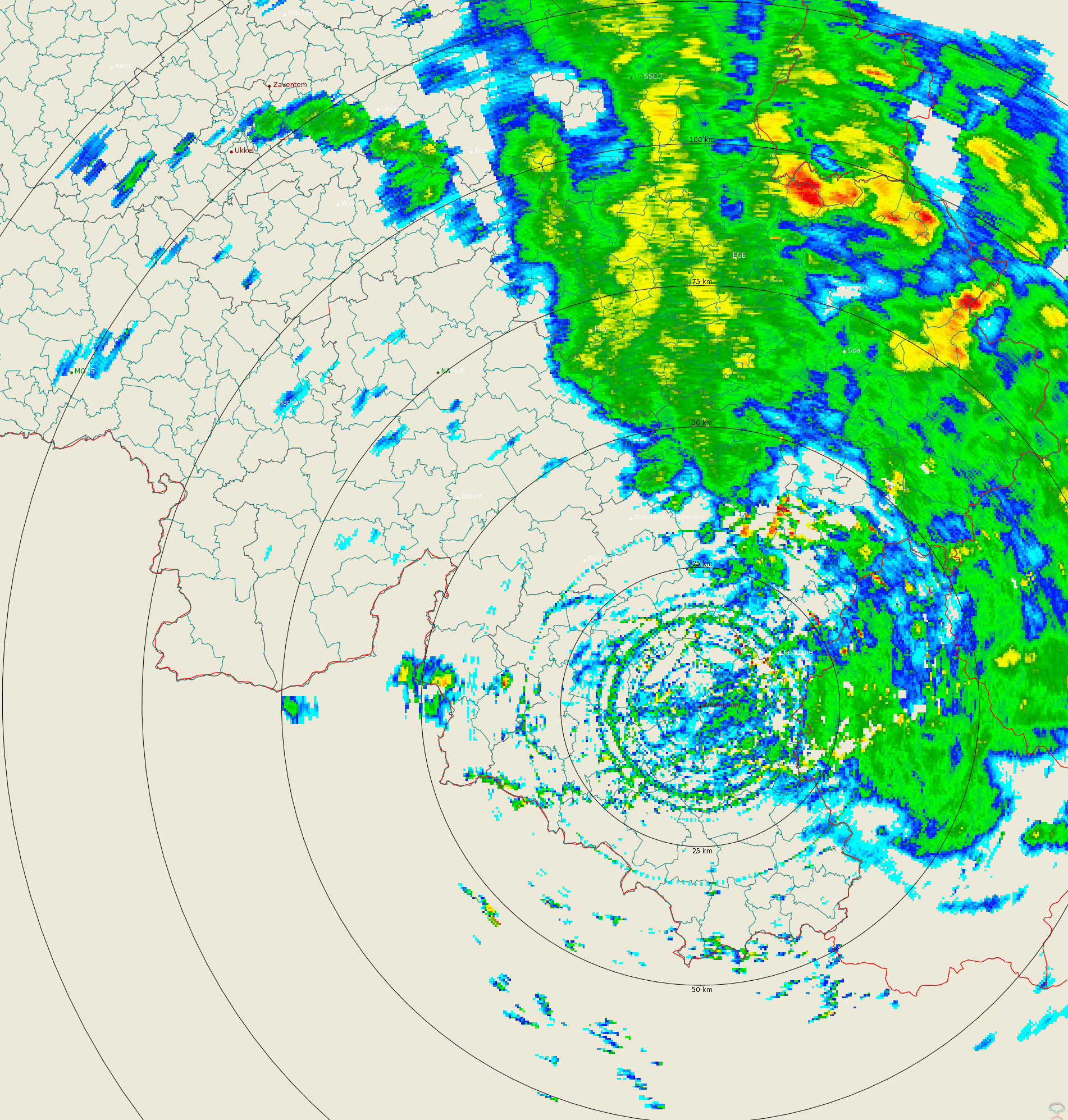
Volume reflectivity data - Wideumont weather radar
Polar volume reflectivity data from the Wideumont weather radar. Volume data files are produced every 5 minutes from a multiple elevation scan.
This product is not publicly available yet.
Simple
- Date (Revision)
- 2025-10-20
- Identifier
- RMI-be / wideumont_volume
- Status
- On going
- Maintenance and update frequency
- Continual
- GEMET - INSPIRE themes, version 1.0
-
- Atmospheric conditions
- Keywords
-
- federal government
- radar
- observation
- Spatial scope
- Access constraints
- Other restrictions
- Other constraints
- No limitations on public access
- Use constraints
- Other restrictions
- Classification
- Unclassified
- Spatial representation type
- Grid
- Distance
- 250 http://standards.iso.org/ittf/PubliclyAvailableStandards/ISO_19139_Schemas/resources /uom/ML_gmxUom.xml#m
- Metadata language
- English
- Topic category
-
- Climatology, meteorology, atmosphere
N
S
E
W
))
- Begin date
- 2016-04-01T00:00:00
- Unique resource identifier
- EPSG:4258
- Distribution format
-
-
HDF
(
5
)
-
HDF
(
5
)
- OnLine resource
-
RMI open data portal
(
WWW:LINK-1.0-http--link
)
RMI open data portal
- Hierarchy level
- Dataset
- Other
- dataset
Domain consistency
- Name of measure
- INSPIRE Conformity
Conformance result
- Date (Publication)
- 2010-12-08
- Explanation
- See the referenced specification
- Pass
- No
- Statement
- Reflectivity data are collected at 15 elevation angles between 0.3 and 25 degrees. A Doppler filtering is applied. An electronic calibration is regularly performed and the quality of the data is monitored using comparison between radar-based precipitation estimates and rain gauge measurements.
- File identifier
- RMI_DATASET_WIDEUMONT_VOLUME XML
- Metadata language
- English
- Hierarchy level
- Dataset
- Date stamp
- 2025-10-20
Overviews
Spatial extent
N
S
E
W
Provided by

Associated resources
Not available