 geo.be Metadata Catalog
Rastervormige observatiegegevens
Données d'observation en grille
Gitterbasierte Beobachtungsdaten
Rasterobservatiegegevens bieden een schatting van de ruimtelijke verdeling van een meteorologische variabele op basis van observaties. Terwijl instrumentele metingen worden uitgevoerd op onregelmatig verdeelde stations, geven rastergegevens de meteorologische variabele weer op een vooraf gedefinieerd regelmatig raster. Rasterobservatiegegevens zijn zeer nuttig in disciplines die gedistribueerde kwantitatieve modellen toepassen om de invloed van het weer en het klimaat te onderzoeken. Rastergegevens zijn ook erg handig om schattingen te geven voor elke specifieke locatie die voor de gebruiker van belang is.
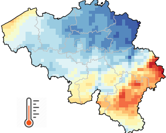
Rasterobservatiegegevens voor België met een ruimtelijke resolutie van 5 km (= 1360 pixels) zijn beschikbaar voor verschillende variabelen (neerslag, luchttemperatuur, zonneschijnduur, zonnestraling, relatieve vochtigheid en windsnelheid) en verschillende temporele resoluties (dagelijkse, maandelijkse, seizoensgebonden en jaarlijkse waarden, alsook langetermijngemiddelden voor het klimaat).
De gerasterde database begint voor de meeste variabelen in 1961 en wordt elke dag bijgewerkt met de beschikbare waarnemingen van de vorige dag. Alle rasters worden vervolgens bijgewerkt voor archivering zodra de gegevenskwaliteitscontrole is voltooid.
Naast de rasters van 5 km x 5 km zijn ook ruimtelijke gemiddelden voor alle Belgische gemeenten beschikbaar.
Dit product is nog niet openbaar beschikbaar.
De dagelijkse klimaatgegevens op rasterbasis zijn beschikbaar voor academische profielen na registratie op onze open data-website.
Les données d'observation maillées fournissent une estimation de la distribution spatiale d'une variable météorologique sur la base d'observations. Alors que les mesures instrumentales sont effectuées dans des stations réparties de manière irrégulière, les données maillées représentent la variable météorologique sur une grille régulière prédéfinie. Les données d'observation maillées sont très utiles dans les disciplines qui appliquent des modèles quantitatifs distribués pour examiner l'influence du temps et du climat. Les données maillées sont également très pratiques pour fournir des estimations pour tout emplacement spécifique intéressant l'utilisateur.
Des données d'observation maillées couvrant la Belgique avec une résolution spatiale de 5 km (= 1360 pixels) sont disponibles pour plusieurs variables (précipitations, température de l'air, durée d'ensoleillement, rayonnement solaire, humidité relative et vitesse du vent) ainsi que pour différentes résolutions temporelles (valeurs quotidiennes, mensuelles, saisonnières, annuelles et moyennes climatiques à long terme).
La base de données maillées commence en 1961 pour la plupart des variables et est mise à jour chaque jour avec les observations disponibles de la veille. Toutes les grilles sont ensuite mises à jour pour archivage dès que le contrôle de la qualité des données est terminé.
En plus des grilles de 5 km x 5 km, des moyennes spatiales pour chaque commune belge sont également disponibles.
Ce produit n'est pas encore accessible au public.
Les données climatiques quotidiennes maillées sont disponibles pour les profils universitaires après inscription sur notre site web de données ouvertes.
Gitterbasierte Beobachtungsdaten liefern eine Schätzung der räumlichen Verteilung einer meteorologischen Variablen auf der Grundlage von Beobachtungen. Während instrumentelle Messungen an unregelmäßig verteilten Stationen durchgeführt werden, stellen gitterbasierte Daten die meteorologische Variable auf einem vordefinierten regelmäßigen Gitter dar. Gitterbasierte Beobachtungsdaten sind von großem Nutzen in Disziplinen, die verteilte quantitative Modelle anwenden, um den Einfluss von Wetter und Klima zu untersuchen. Gitterbasierte Daten sind auch sehr praktisch, um Schätzungen für jeden spezifischen Ort zu liefern, der für den Nutzer von Interesse ist.
Gitterbasierte Beobachtungsdaten für Belgien mit einer räumlichen Auflösung von 5 km (= 1360 Pixel) sind für verschiedene Variablen (Niederschläge, Lufttemperatur, Sonnenscheindauer, Sonneneinstrahlung, relative Luftfeuchtigkeit und Windgeschwindigkeit) sowie für verschiedene zeitliche Auflösungen (tägliche, monatliche, saisonale, jährliche Werte sowie langfristige Klimadurchschnittswerte) verfügbar.
Die gerasterte Datenbank beginnt für die meisten Variablen im Jahr 1961 und wird täglich mit den verfügbaren Beobachtungen des Vortages aktualisiert. Alle Raster werden dann zur Archivierung aktualisiert, sobald die Datenqualitätskontrolle abgeschlossen ist.
Zusätzlich zu den 5 km x 5 km-Rastern sind auch räumliche Durchschnittswerte für alle belgischen Gemeinden verfügbar.
Dieses Produkt ist noch nicht öffentlich verfügbar.
Die täglichen Klimadaten im Gitterraster stehen nach der Registrierung auf unserer Open-Data-Website für akademische Profile zur Verfügung.
Simple
-
Date (Révision)Datum (revisie)Datum (Überarbeitung)
- 2025-10-08
-
IdentificateurIdentifierIdentifikator
- RMI-be / griddedobs
-
EtatStatusBearbeitungsstatus
-
Mise à jour continuecontinu geactualiseerdKontinuierliche Aktualisierung
-
Fréquence de mise à jourHerzieningsfrequentieÜberarbeitungsintervall
-
JournalièredagelijksTäglich
- GEMET - INSPIRE themes, version 1.0
-
-
Meteorologische geografische kenmerkenCaractéristiques géographiques météorologiquesMeteorologisch-geografische Kennwerte
-
- Keywords
-
- Reporting INSPIRE
- federal government
- observation
- interpolated observations
- climate grids
- belgian municipalities
- air temperature
- precipitation
- wind speed
- solar radiation
- sunshine duration
- relative humidity
- Spatial scope
-
Contraintes d'accès(Juridische) toegangsrestrictieZugriffseinschränkungen
-
Autres restrictionsandersBenutzerdeifinierte Einschränkungen
-
Overige beperkingenAutres contraintesAndere Einschränkungen
-
Geen beperkingen op openbare toegangPas de restrictions concernant l'accès publicÖffentliche Zugang nicht beschränkt
-
Contraintes d'utilisation(Juridische) gebruiksbeperkingNutzungseinschränkungen
-
Autres restrictionsandersBenutzerdeifinierte Einschränkungen
-
Restrictions de manipulationVeiligheidsrestrictiesSicherheitseinstufung
-
Non classifiévrij toegankelijkUnbeschränkt
-
Type de représentation spatialeRuimtelijk schemaRäumliche Darstellungsart
-
RastergridRaster, Gitter
-
LangueTaalSprache
- English
-
Catégorie ISOOnderwerpThematik
-
-
Climatologie/Météorologie/Atmosphèreklimatologie, meteorologie atmosfeerAtmosphäre
-
))
- Begin date
- 1961-01-01T00:00:00
- Unique resource identifier
- EPSG:4258
-
Format (encodage)Distributie formaatAbgabeformat
-
-
CSV
(
1.0
)
-
CSV
(
1.0
)
-
Ressource en ligneOnLine bronnenOnline
-
KMI open data portaal Portail de données ouvertes de l'IRM KMI-Portal für offene Daten
(
WWW:LINK-1.0-http--link
)
KMI open data portaalPortail de données ouvertes de l'IRMKMI-Portal für offene Daten
-
NiveauNiveau kwaliteitsbeschrijvingBezugsebene
-
Jeu de donnéesdatasetDatenbestand
- Other
- dataset
Cohérence du domaine de valeurs
Domain consistentie
Konsistenz des Wertebereichs
- Name of measure
- INSPIRE Conformity
Résultat de conformité
Resultaat conformiteit met de specificatie
Konformitätsergebnis
-
Date (Publication)Datum (publicatie)Datum (Publikation)
- 2010-12-08
- Explanation
- See the referenced specification
-
Degré de conformitéIndicatie van conformiteit met de specificatieBestanden
- No
-
Algemene beschrijving herkomstGénéralités sur la provenanceErläuterung
-
De klimaatroosters zijn het resultaat van de ruimtelijke interpolatie van waarnemingen. De interpolatiemethode wordt aangepast aan elke variabele en temporele resolutie. Waar mogelijk integreren de betrokken statistische procedures naast de waarnemingen ook sterk gecorreleerde aanvullende gegevens. Om enkele voorbeelden te noemen: de luchttemperatuur wordt beïnvloed door verschillende factoren, zoals de hoogte van het terrein en de nabijheid van wateroppervlakken. Zonnestraling wordt voornamelijk bepaald door bewolking, die kan worden gekarakteriseerd aan de hand van Meteosat-satellietgegevens.Les grilles climatiques résultent de l'interpolation spatiale des observations. La méthode d'interpolation est adaptée à chaque variable et à chaque résolution temporelle. Lorsque cela est possible, les procédures statistiques utilisées intègrent, en plus des observations, des données auxiliaires fortement corrélées. Pour citer quelques exemples, la température de l'air est influencée par plusieurs facteurs tels que l'altitude du terrain et la proximité de surfaces aquatiques. Le rayonnement solaire est principalement déterminé par la couverture nuageuse, qui peut être caractérisée à l'aide des données du satellite Meteosat.Die Klimagitter sind das Ergebnis einer räumlichen Interpolation von Beobachtungen. Die Interpolationsmethode wird an jede Variable und zeitliche Auflösung angepasst. Wenn möglich, werden bei den statistischen Verfahren zusätzlich zu den Beobachtungen auch stark korrelierte Zusatzdaten berücksichtigt. Um nur einige Beispiele zu nennen: Die Lufttemperatur wird von mehreren Faktoren beeinflusst, darunter die Höhe des Geländes und die Nähe zu Gewässern. Die Sonneneinstrahlung wird hauptsächlich von der Bewölkung bestimmt, die anhand von Meteosat-Satellitendaten charakterisiert werden kann.
-
Identifiant de la ficheMetadata IDMetadatensatzidentifikator
- RMI_DATASET_GRIDDEDOBS XML
-
LangueTaalSprache
- English
-
Type de ressourceHierarchisch niveauHierarchieebene
-
Jeu de donnéesdatasetDatenbestand
-
Date des métadonnéesMetadata datumDatum
- 2025-10-08
Overviews
Spatial extent
Provided by
