geo.be Metadata Catalog
User reports from the RMI smartphone app
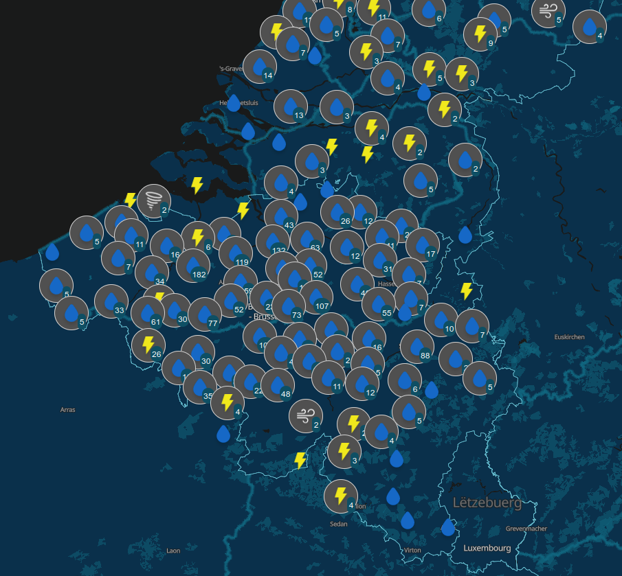
Since August 2019, users of the RMI smartphone app are able to send an observation of the meteorological conditions at a certain place and a certain time. The observations provide information about the weather conditions and potentially severe weather to the other users and to RMI. The collection of citizen weather reports is a valuable complement to the information obtained with the classical instruments like stations, radar and satellite. The data can be exploited for nowcasting, warnings and model verification, and eventually in assimilation. A general introduction of the data and their characteristics can be found in Reyniers et al. (2023).
A basic quality control is implemented on the received observations via a plausibility check. This plausibility check determines whether an observation is plausible, suspicious or false, by comparing it to the INCA-BE nowcasting system using a simple thresholding scheme. INCA-BE is RMI's operational nowcasting system described in Reyniers et al. (2021).
There is no strict spatial extent since there is no restriction at the input side: users can send observations from all over the globe. The bulk of the observations are received from within Belgium. Note that the plausibility check is not available for reports from outside Belgium.
Simple
- Date (Creation)
- 2019-08-01
- Citation identifier
- RMI-be / appobs
- Status
- On going
- Point of contact
-
Organisation name Individual name Electronic mail address Role Royal Meteorological Institute of Belgium
Point of contact Royal Meteorological Institute of Belgium
Owner
-
GEMET - INSPIRE themes, version 1.0
-
-
Atmospheric conditions
-
- Keywords
-
-
federal government
-
crowdsourscing
-
citizen science
-
severe weather
-
natural risks
-
cloudiness
-
precipitation
-
hail
-
wind
-
wind gust
-
whirlwind
-
floods
-
snow
-
road conditions
-
fog
-
optical phenomena
-
-
Spatial scope
- Access constraints
- Other restrictions
- Other constraints
- No limitations on public access
- Use constraints
- Other restrictions
- Classification
- Unclassified
- Spatial representation type
- Vector
- Language
- English
- Topic category
-
- Climatology, meteorology, atmosphere
))
- Begin date
- 2019-08-01T00:00:00
- Unique resource identifier
- EPSG:4258
- Distribution format
-
Name Version CSV
1.0
GeoJSON
1.0
Digital transfer options
- OnLine resource
-
Protocol Linkage Name WWW:LINK-1.0-http--link
https://opendata.meteo.be
Digital transfer options
- OnLine resource
-
Protocol Linkage Name OGC:WMS-1.3.0-http-get-capabilities https://opendata.meteo.be/service/appobs/wms?service=WMS&version=1.3.0&request=getCapabilities appobs:appobs
Digital transfer options
- OnLine resource
-
Protocol Linkage Name OGC:WFS-1.0.0-http-get-capabilities https://opendata.meteo.be/service/appobs/wfs?service=WFS&version=1.1.0&request=GetCapabilities appobs:appobs
Digital transfer options
- OnLine resource
-
Protocol Linkage Name WWW:LINK-1.0-http--link
https://opendata.meteo.be/documentation/?dataset=appobs Documentation
Digital transfer options
- OnLine resource
-
Protocol Linkage Name WWW:LINK-1.0-http--link
https://doi.org/10.5281/zenodo.5798952
Digital transfer options
- OnLine resource
-
Protocol Linkage Name WWW:LINK-1.0-http--link
https://doi.org/10.5194/ecss2023-50
- Hierarchy level
- Dataset
- Other
-
dataset
Domain consistency
- Name of measure
-
INSPIRE Conformity
Conformance result
- Title
-
Commission Regulation (EU) No 1089/2010 of 23 November 2010 implementing Directive 2007/2/EC of the European Parliament and of the Council as regards interoperability of spatial data sets and services
- Date (Publication)
- 2010-12-08
- Explanation
-
See the referenced specification
- Pass
- No
- Statement
-
A basic quality control is implemented in the form of a plausibility check. Possible outcomes of this plausibility check for the validity of an observation are: 'possible', 'suspicious' or 'false'. This assessment is made immediately after the reception of the observation by comparing it to the latest INCA-BE output. There is no offline revision of this plausibility at a later time.
Metadata
- File identifier
- RMI_DATASET_APPOBS XML
- Metadata language
- English
- Hierarchy level
- Dataset
- Date stamp
- 2025-09-08
- Metadata author
-
Organisation name Individual name Electronic mail address Role Royal Meteorological Institute of Belgium
Point of contact
- Other language
-
Language Character encoding French UTF8 Dutch; Flemish UTF8 German UTF8