 geo.be Metadata Catalog
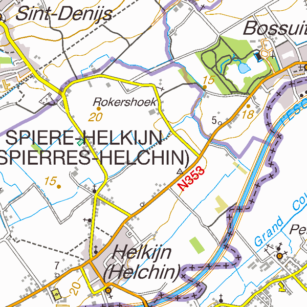
Top50Map
Top50Map is a digital version of the NGI’s topographic cartography on a scale of 1:50 000. The images come from the symbolisation of the objects and the themes in the topo-geographic inventory of the Belgian territory (ITGI), which is built and kept up-to-date by the NGI. It can be used for on-screen viewing or printed on scales between 1:25 000 and 1:50 000 (recommended threshold values). Top50Map is meant for regional use.
Simple
- Date (Creation)
- 2010-05-04
- Date (Revision)
- 2010-05-04
- Identifier
- BE.NGI-IGN / 9638d88f-808e-11e9-9598-482ae30f98d9
- Status
- Completed
Custodian
National Geographic Institute
-
Frédérique Spitaels
Kortenberglaan 115
,
Brussels
,
1000
,
Belgium
http://www.ngi.be
- Maintenance and update frequency
- Quarterly
- Use limitation
- https://creativecommons.org/licenses/by/4.0/
- Access constraints
- Other restrictions
- Other constraints
- No limitations on public access
- Use constraints
- Other restrictions
- Other constraints
- https://creativecommons.org/licenses/by/4.0/
- Spatial representation type
- Grid
- Distance
- 3 m
- Metadata language
- Deutsch
- Metadata language
- Nederlands; Vlaams
- Metadata language
- Français
- Character set
- 8859 Part 15
- Topic category
-
- Transportation
- Structure
- Boundaries
- Description
- Belgium
N
S
E
W
))
- Unique resource identifier
- EPSG:31370
- Codespace
- EPSG
- Unique resource identifier
- EPSG:3812
- Codespace
- EPSG
- Distribution format
-
-
TIFF
(
)
-
TIFF
(
)
- OnLine resource
-
View service
(
OGC:WMS
)
View service
- OnLine resource
- https://ac.ngi.be/catalogue/getopenaccess/ngi-specs/Top50Map_ProductSpecification_V4_NL.pdf ( WWW:LINK-1.0-http--link )
- OnLine resource
-
https://ac.ngi.be/catalogue/order/ngi-standard/Rasterdata/Top50Map?language=en
Direct access to the webshop
- OnLine resource
-
https://shop.ngi.be/nl/bekijk-op-de-kaart/?x=658521.5&y=633841.5&r=417.44&c=topo_50
(
WWW:LINK-1.0-http--link
)
Order of the paper resource
- Hierarchy level
- Dataset
Domain consistency
- Name of measure
- INSPIRE Conformity
Conformance result
- Date (Publication)
- 2010-12-08
- Explanation
- The dataset’s compliance with the technical requirements as defined by the Commission Regulation (EU) No 1089/2010 of 23 November 2010 has not been checked
- Statement
- Top50Map is made by automatic symbolisation. The topo-geographic data set for the 1:50 000 scale is made by generalisation, starting from the reference data set, in order to be suitable for regional use.
- File identifier
- 9636dcc0-808e-11e9-a657-482ae30f98d9 XML
- Metadata language
- English
- Character set
- UTF8
- Hierarchy level
- Static map
- Date stamp
- 2024-07-30T09:43:09
- Metadata standard name
- ISO 19115:2003/19139
- Metadata standard version
- 1.0
Point of contact
National Geographic Institute
-
Floor Van Damme
Kortenberglaan 115
,
Brussels
,
1000
,
Belgium
http://www.ngi.be
Overviews
Spatial extent
N
S
E
W
Provided by

Associated resources
Not available