 geo.be Metadata Catalog
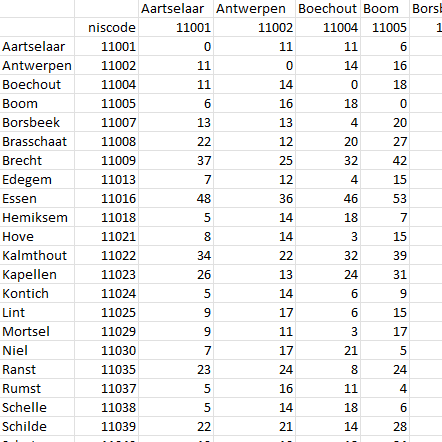
distance matrix between the centers of municipalities
Simple
- Date (Creation)
- 2022-12-19
- Date (Revision)
- 2025-03-17
- Identifier
- BE.NGI-IGN / 4884dd4f-41bf-11ee-b2f7-186571a04de2
- Status
- Completed
- Maintenance and update frequency
- As needed
- Keywords
-
- distance matrix
- Use constraints
- Other restrictions
- Other constraints
-
•The custodian of the resource holds the rights of property (including the rights of intellectual property) to the geographic files
•The custodian grants the user the right to use the data for his internal use.
•Commercial use of the data under any form is strictly forbidden
•Custodian’s name must be mentioned each time the data are being used publically.
- Access constraints
- Other restrictions
- Other constraints
- No limitations on public access
- Use limitation
-
•The custodian of the resource holds the rights of property (including the rights of intellectual property) to the geographic files
•The custodian grants the user the right to use the data for his internal use.
•Commercial use of the data under any form is strictly forbidden
•Custodian’s name must be mentioned each time the data are being used publically.
- Spatial representation type
- Text, table
- Metadata language
- Deutsch
- Metadata language
- Français
- Metadata language
- Nederlands; Vlaams
- Character set
- 8859 Part 15
- Description
- Belgium
))
- OnLine resource
-
Direct download of resource
(
WWW:DOWNLOAD-1.0-http--download
)
Direct download of resource
- OnLine resource
-
Direct download of resource
(
WWW:DOWNLOAD-1.0-http--download
)
Direct download of resource
- Hierarchy level
- Dataset
Domain consistency
- Name of measure
- INSPIRE Conformity
Conformance result
- Date (Publication)
- 2010-12-08
- Explanation
- The dataset’s compliance with the technical requirements as defined by the Commission Regulation (EU) No 1089/2010 of 23 November 2010 has not been checked
- Statement
- The distance matrix is the result of a calculation using the road network built with TomTom multinet data in the ArcGIS Pro Origin-Destination cost matrix tool. The distance between a point representing a commune centre and the road network is less than 170 metres. The calculation takes into account one-way roads and avoids special roads such as pedestrian zones, roads under construction, exceptional transport, ...
- File identifier
- 4884dd4f-41bf-11ee-b2f7-186571a04de2 XML
- Metadata language
- English
- Character set
- UTF8
- Hierarchy level
- Dataset
- Date stamp
- 2026-02-03T11:42:25
- Metadata standard name
- ISO 19115:2003/19139
- Metadata standard version
- 1.0
Overviews
Spatial extent
Provided by
