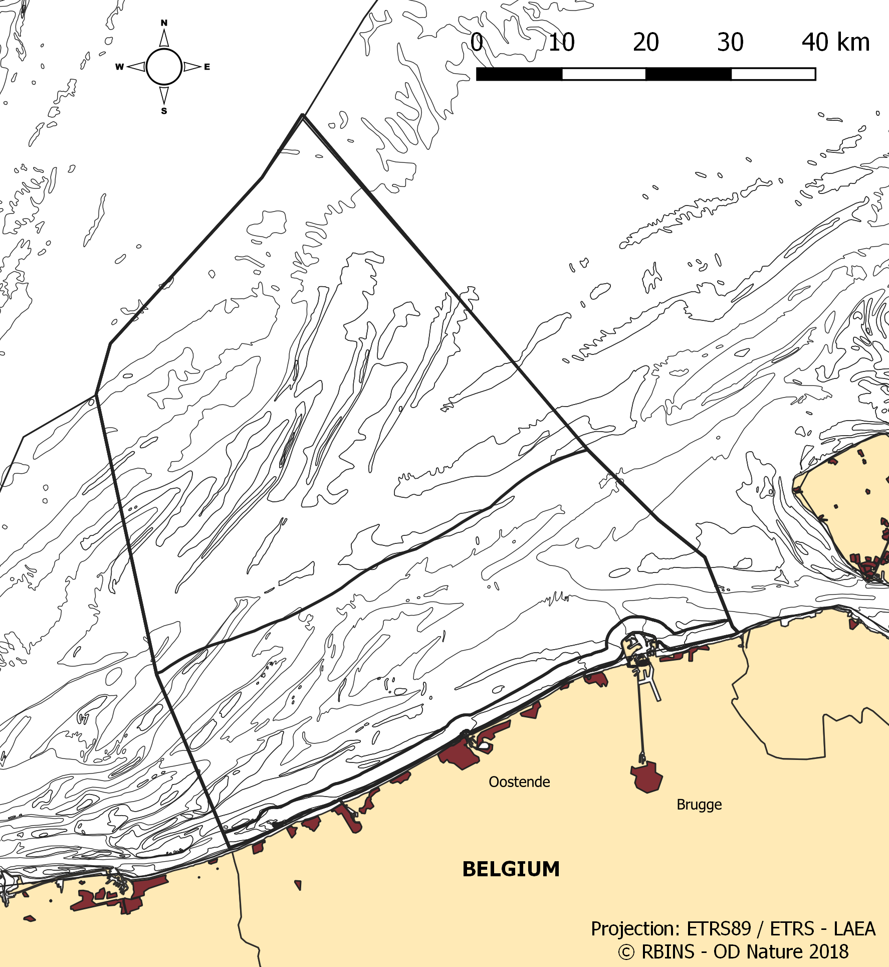
Marine Reporting Units dans la zone Belge de la Mer du Nord
L'ensemble de données contient les frontières des eaux marines belges de la mer du Nord et les différentes zones géographiques (`` unités déclarantes '') utilisées lors de la déclaration dans le cadre de la directive-cadre pour la stratégie marine 2008/56 / CE (MSFD) et du cadre pour l'eau directive 2000/60 / CE (DCE). L'état écologique dans le cadre de la DCE est signalé pour les eaux côtières, définies comme la zone d'un mille marin, tandis que l'état chimique doit être déclaré pour les eaux territoriales (jusqu'à 12 milles marins). MSFD a besoin d'informations sur l'ensemble de la zone, englobant les eaux territoriales et la zone économique exclusive belge. Pour certains descripteurs, les résultats ont été rapportés séparément pour les subdivisions de la DCE lors de la mise à jour de l'évaluation initiale en 2018.
Simple
- Date (Création)
- 2021-11-18
- Date (Révision)
- 2021-11-22
- Date (Publication)
- 2026-02-12
- Date (Création)
- 2016-05-19
- Identificateur
-
http://metadata.naturalsciences.be
/
29f40b0d-2a3e-49a8-870a-e9b4acd4d1e3
- Date
- Autres informations de référence
- This dataset is composed of the following sources: Marine Reporting Units in the Belgian Part of the North Sea.
A l’origine de
Royal Belgian Institute for Natural Sciences (RBINS), Directorate Natural Environment (OD Nature), GeoCell
Editeur (publication)
Institut royal des Sciences naturelles de Belgique (IRSNB)
https://www.naturalsciences.be
https://www.naturalsciences.be
Auteur
Royal Belgian Institute for Natural Sciences (RBINS), Directorate Natural Environment (OD Nature)
https://odnature.naturalsciences.be/
https://odnature.naturalsciences.be/
Propriétaire
Institut royal des Sciences naturelles de Belgique (IRSNB)
https://www.naturalsciences.be
https://www.naturalsciences.be
Gestionnaire
Institut royal des Sciences naturelles de Belgique (IRSNB), Direction opérationnelle Milieux naturels (DO Nature), Belgian Marine Data Centre (BMDC)
https://www.bmdc.be
https://www.bmdc.be
- Thème
-
- Gouvernement Fédéral
- Area management/restriction/regulation zones and reporting units
- Marine essentials
- One mile zone
- Reporting INSPIRE
- Twelve mile zone
- Contraintes d'utilisation
- Autres restrictions
- Autres contraintes
- No conditions apply to access and use
- Autres contraintes
- https://creativecommons.org/licenses/by/4.0/
- Contraintes d'accès
- Autres restrictions
- Autres contraintes
- Pas de restrictions concernant l'accès public.
- Limitation d'utilisation
- Aucune condition ne s'applique à l'utilisation.
- Restrictions de manipulation
- Non classifié
- Type de représentation spatiale
- Vecteur
- Langue
- English
- Catégorie ISO
-
- Environnement
- Océans
N
S
E
W
))
- Exclusion
- Oui
- Date
- Code
- North Sea
- gml32:beginPosition
- 2014-01-01
- Nom du système de référence
- http://www.opengis.net/def/crs/EPSG/0/4258
- Format (encodage)
-
-
application/xml
(
Unknown
)
-
application/xml
(
Unknown
)
Distributeur
Gestionnaire
Institut royal des Sciences naturelles de Belgique (IRSNB), Direction opérationnelle Milieux naturels (DO Nature), Belgian Marine Data Centre (BMDC)
https://www.bmdc.be
https://www.bmdc.be
- Nom
- application/xml
- Version
- Unknown
- Taille de transfert
- 0.22797
- Ressource en ligne
-
od_nature:marine_reporting_units
(
OGC:WMS
)
A WMS service to view a map
Distributeur
Gestionnaire
Institut royal des Sciences naturelles de Belgique (IRSNB), Direction opérationnelle Milieux naturels (DO Nature), Belgian Marine Data Centre (BMDC)
https://www.bmdc.be
https://www.bmdc.be
- Nom
- application/xml
- Version
- Unknown
- Taille de transfert
- 0.110439
- Ressource en ligne
-
od_nature:marine_reporting_units
(
OGC:WFS
)
A WFS service to download
- Ressource en ligne
- Digital Object Identifier (DOI) ( DOI )
- Niveau
- Jeu de données
Résultat de conformité
- Date (Publication)
- 2010-12-08
- Explication
- Voir la spécification référencée
- Degré de conformité
- Oui
- Généralités sur la provenance
- Le jeu de données a été fusionné à partir de plusieurs shapefiles ESRI existants d'unités de déclaration maritime, reprojeté vers ETRS89-LAEA et enregistré comme un nouveau shapefile. Le jeu de données est proposé sous la forme du fichier de forme résultant et d'un fichier GML harmonisé par INSPIRE.
- Identifiant de la fiche
- 29f40b0d-2a3e-49a8-870a-e9b4acd4d1e3 XML
- Langue
- English
- Jeu de caractères
- Utf8
- Type de ressource
- Jeu de données
- Date des métadonnées
- 2026-02-12T16:29:44.604Z
- Nom du standard de métadonnées
- Geographic information -- Metadata
- Version du standard de métadonnées
- ISO 19115:2003/19139
Aperçus

large_thumbnail
Étendue spatiale
N
S
E
W
))
Fourni par

Ressources associées
Not available
 geo.be Metadata Catalog