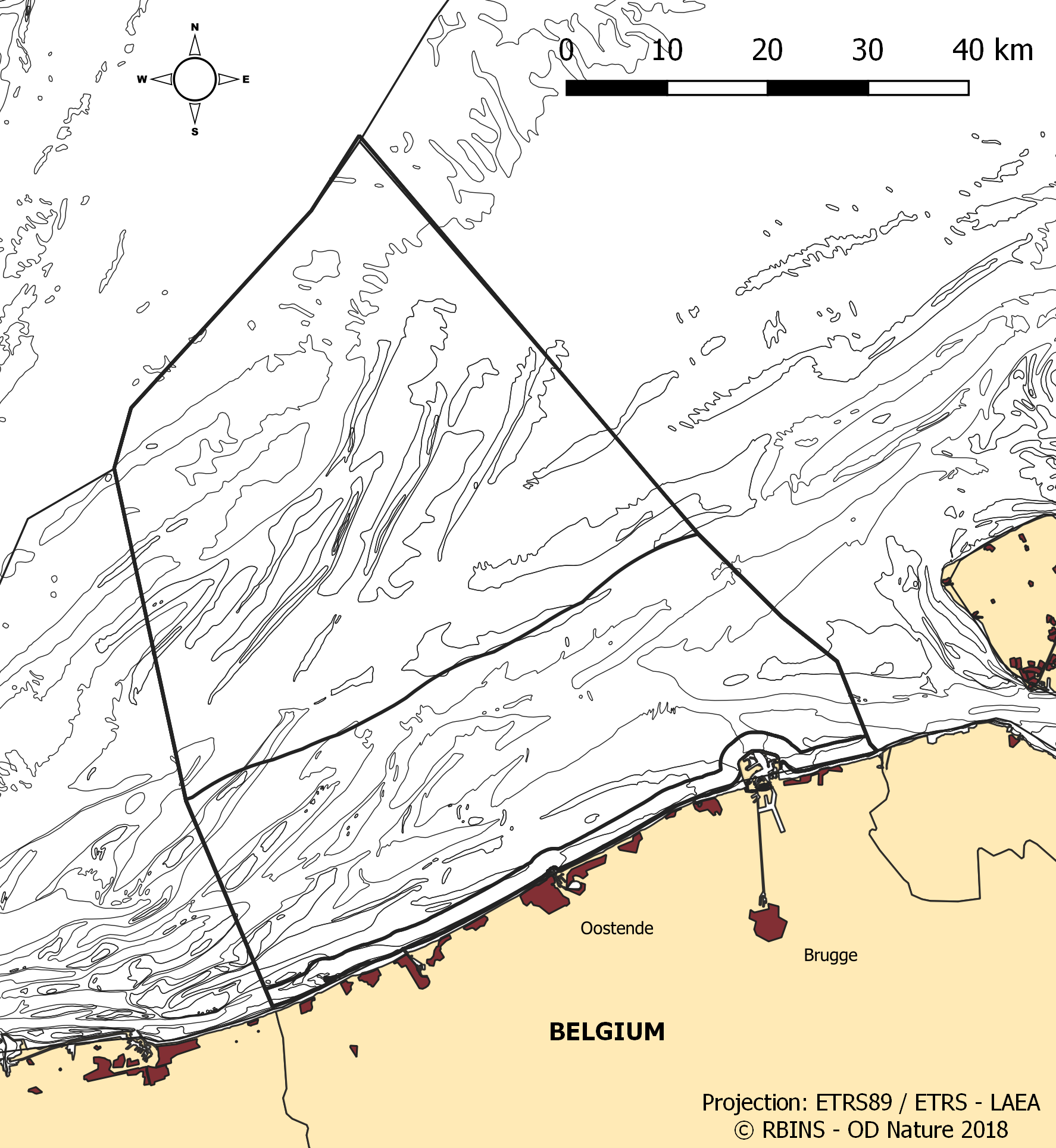
Marine Reporting Units in het Belgisch deel van de Noordzee
De dataset bevat de grenzen van de Belgische mariene wateren in de Noordzee en de verschillende geografische gebieden ('rapportage-eenheden') die worden gebruikt bij rapportage in het kader van de Kaderrichtlijn Mariene Strategie 2008/56 / EG (KRMS) en het Water Framework richtlijn 2000/60 / EG (KRW). De ecologische status in het kader van de KRW wordt gerapporteerd voor de kustwateren, gedefinieerd als het zeemijlgebied, terwijl de chemische status moet worden gerapporteerd voor de territoriale wateren (tot 12 zeemijlen). KRMS vereist informatie voor het hele gebied, inclusief de territoriale wateren en de Belgische exclusieve economische zone. Voor sommige descriptoren zijn de resultaten afzonderlijk gerapporteerd voor de KRW-onderverdelingen tijdens de update van de eerste beoordeling in 2018.
Standaard
- Datum (creatie)
- 2021-11-18
- Datum (revisie)
- 2021-11-22
- Datum (publicatie)
- 2026-02-12
- Datum (creatie)
- 2016-05-19
- Identifier
-
http://metadata.naturalsciences.be
/
29f40b0d-2a3e-49a8-870a-e9b4acd4d1e3
- Datum
- Overige citatie details
- This dataset is composed of the following sources: Marine Reporting Units in the Belgian Part of the North Sea.
uitgever
Koninklijk Belgisch Instituut voor Natuurwetenschappen (KBIN)
https://www.naturalsciences.be
https://www.naturalsciences.be
auteur
Royal Belgian Institute for Natural Sciences (RBINS), Directorate Natural Environment (OD Nature)
https://odnature.naturalsciences.be/
https://odnature.naturalsciences.be/
eigenaar
Koninklijk Belgisch Instituut voor Natuurwetenschappen (KBIN)
https://www.naturalsciences.be
https://www.naturalsciences.be
beheerder
Koninklijk Belgisch Instituut voor Natuurwetenschappen (KBIN), Operationele Directie Natuurlijk Milieu (OD Natuur), Belgian Marine Data Centre (BMDC)
https://www.bmdc.be
https://www.bmdc.be
- theme
-
- Federale Overheid
- Area management/restriction/regulation zones and reporting units
- Marine essentials
- One mile zone
- Reporting INSPIRE
- Twelve mile zone
- (Juridische) gebruiksbeperking
- anders
- Overige beperkingen
- No conditions apply to access and use
- Overige beperkingen
- https://creativecommons.org/licenses/by/4.0/
- (Juridische) toegangsrestrictie
- anders
- Overige beperkingen
- Geen beperkingen op openbare toegang.
- Gebruiksbeperkingen
- Geen voorwaarden in verband met gebruik.
- Veiligheidsrestricties
- vrij toegankelijk
- Ruimtelijk schema
- vector
- Taal
- English
- Onderwerp
-
- natuur en milieu
- oceanen
N
S
E
W
))
- Dekking type code
- Ja
- Datum
- Code
- North Sea
- gml32:beginPosition
- 2014-01-01
- Referentiesysteem identifier
- http://www.opengis.net/def/crs/EPSG/0/4258
- Distributie formaat
-
-
application/xml
(
Unknown
)
-
application/xml
(
Unknown
)
Distributeur
beheerder
Koninklijk Belgisch Instituut voor Natuurwetenschappen (KBIN), Operationele Directie Natuurlijk Milieu (OD Natuur), Belgian Marine Data Centre (BMDC)
https://www.bmdc.be
https://www.bmdc.be
- Naam
- application/xml
- Versie
- Unknown
- Bestands grootte
- 0.22797
- OnLine bronnen
-
od_nature:marine_reporting_units
(
OGC:WMS
)
A WMS service to view a map
Distributeur
beheerder
Koninklijk Belgisch Instituut voor Natuurwetenschappen (KBIN), Operationele Directie Natuurlijk Milieu (OD Natuur), Belgian Marine Data Centre (BMDC)
https://www.bmdc.be
https://www.bmdc.be
- Naam
- application/xml
- Versie
- Unknown
- Bestands grootte
- 0.110439
- OnLine bronnen
-
od_nature:marine_reporting_units
(
OGC:WFS
)
A WFS service to download
- OnLine bronnen
- Digital Object Identifier (DOI) ( DOI )
- Niveau kwaliteitsbeschrijving
- dataset
Resultaat conformiteit met de specificatie
- Datum (publicatie)
- 2010-12-08
- Uitleg
- Zie de gerefereerde specificatie
- Indicatie van conformiteit met de specificatie
- Ja
- Algemene beschrijving herkomst
- De dataset is samengevoegd uit verschillende bestaande ESRI shapefiles van mariene rapportage-eenheden, geherprojecteerd naar ETRS89-LAEA en opgeslagen als een nieuwe shapefile. De dataset wordt aangeboden als het resulterende shapefile en een INSPIRE-geharmoniseerd GML-bestand.
- Metadata ID
- 29f40b0d-2a3e-49a8-870a-e9b4acd4d1e3 XML
- Taal
- English
- Karakterset
- utf8
- Hierarchisch niveau
- dataset
- Metadata datum
- 2026-02-12T16:29:44.604Z
- Metadata standaard naam.
- Geographic information -- Metadata
- Metadata standaard versie
- ISO 19115:2003/19139
 geo.be Metadata Catalog

