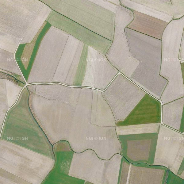
View service - Orthophoto
Orthophotos are digital aerial photographs in which the systematic distortions caused by the central projection, terrain relief and an image acquisition axis that is not always perfectly vertical have been corrected. The national orthophoto coverage is renewed annually.
This view service makes it possible to visualise the national orthophoto mosaics for multiple acquisition campaigns from 2016 onwards for the entire territory of Belgium. A separate layer is published for each available year. In the current version of the service, the series of yearly layers runs from 2016 up to and including 2023, with 2023 being the most recent orthophoto coverage in this view service.
For the 2016–2021 campaigns, the orthophotos have a spatial resolution of 25 cm throughout Belgium. From the 2022 campaign onwards, the resolution is 25 cm in Wallonia and 15 cm in Flanders and the Brussels-Capital Region. The view service is directly based on the orthophoto datasets of the Belgian administrative Regions, which are harmonised by NGI into a single national coverage without applying additional radiometric corrections.
The orthophoto coverage is provided through this Web Map Service (WMS) and is intended for visualisation and use as a background map. For downloading the most recent orthophoto mosaics, reference is made to the associated dataset and download service “Orthophoto”.
Simple
Identification info
- Date (Creation)
- 2017-03-15
- Date (Revision)
- 2024-04-15
- Identifier
- BE.NGI-IGN / 29238f19-ac79-4a4a-a797-5490226381ec
- Annex D4 of the European Commission Regulation 1205/2008
- Use limitation
- https://creativecommons.org/licenses/by/4.0/
- Access constraints
- Other restrictions
- Other constraints
- No limitations on public access
- Use constraints
- Other restrictions
- Other constraints
- https://creativecommons.org/licenses/by/4.0/
- Service Type
- view
- Description
- Belgium
))
Coupled Resource
- Operation Name
- GetCapabilities
- Identifier
- e59181f0-8469-44c6-8f6c-a5e1a4af15d5
- Coupling Type
- Tight
Contains Operations
- Operation Name
- GetCapabilities
- Distributed Computing Platforms
- Web services
- Connect Point
- https://wms.ngi.be/inspire/ortho/service ( OGC:WMS )
- Operates On
- Reference system identifier
- EPSG:3035
- Reference system identifier
- EPSG:4258
- Reference system identifier
- EPSG:3857
- Reference system identifier
- EPSG:4326
- Reference system identifier
- EPSG:3812
- OnLine resource
-
View service
(
OGC:WMS
)
View service
- OnLine resource
-
View service
(
OGC:WMTS
)
View service
- Hierarchy level
- Service
- Other
- Webmap Service
Domain consistency
- Name of measure
- INSPIRE Conformity
Conformance result
- Date (Publication)
- 2009-08-19
- Explanation
- The service described meets the technical requirements as defined by the Commission Regulation (EC) No 976/2009 of 19 October 2009
- Pass
- Yes
- File identifier
- 29238f19-ac79-4a4a-a797-5490226381ec XML
- Metadata language
- English
- Character set
- UTF8
- Hierarchy level
- Service
- Hierarchy level name
- Webmap Service
- Date stamp
- 2026-02-03T11:18:01
- Metadata standard name
- ISO 19115:2003/19139
- Metadata standard version
- 1.0
Overviews

Spatial extent
))
Provided by

 geo.be Metadata Catalog