geo.be Metadata Catalog
Urban Atlas 2012
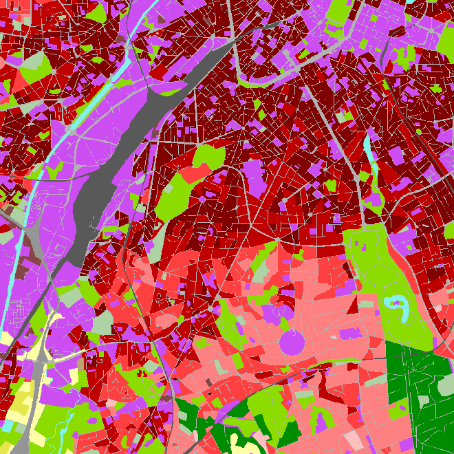
The European Urban Atlas provides reliable, inter-comparable, high-resolution land use and land cover data for 800 Functional Urban Area (FUA) for the 2012 reference year in EEA39 countries. This datasets contains the FUA for Belgium (Antwerpen, Brugge, Bruxelles_Brussel, Charleroi, Gent, Kortrijk, Leuven, Liege, Mons, Namur and Oostende).
Simple
- Date (Creation)
- 2016-08-04
- Citation identifier
- EEA / edaf6c6e-2557-11e9-ac07-14abc58d5215
- Credit
-
Data was produced with funding by the European Union. Copyright Copernicus Programme
DISCLAIMER: National Geographic Institute has undertaken to distribute the data on behalf of EEA under Specific Contract No 3436/R0-Copernicus/EEA.57005 implementing Framework service contract No EEA/IDM/R0/16/009/Belgium. National Geographic Institute accepts no responsibility or liability whatsoever with regard to the content and use of these data.”
The European Environment Agency accepts no responsibility or liability whatsoever with regard to the information on this site and the information does not necessarily reflect the official opinion of the EEA or other European Communities bodies and institutions.
- Status
- Completed
- Point of contact
-
Organisation name Individual name Electronic mail address Role National Geographic Institute
Johannes Van Geertsom
Custodian
- Maintenance and update frequency
- Unknown
- Keywords
-
-
2012
-
Urban Atlas
-
UA2012
-
Land
-
Copernicus
-
HVD_cat_land use, HVD_cat_land cover
-
- Use limitation
- https://creativecommons.org/licenses/by/4.0/
- Access constraints
- Other restrictions
- Other constraints
- No limitations on public access
- Use constraints
- Other restrictions
- Other constraints
- https://creativecommons.org/licenses/by/4.0/
- Spatial representation type
- Vector
- Language
- English
- Character set
- 8859 Part 15
- Description
-
Belgium
))
- Unique resource identifier
- EPSG:3812
- Codespace
-
EPSG
- Distribution format
-
Name Version Esri Shapefile
Digital transfer options
- OnLine resource
-
Protocol Linkage Name OGC:WMS
https://wms.ngi.be/inspire/copernicus/service?request=GetCapabilities&service=WMS&version=1.3.0
Digital transfer options
- OnLine resource
-
Protocol Linkage Name WWW:LINK-1.0-http--link
https://land.copernicus.eu/local/urban-atlas
Digital transfer options
- OnLine resource
-
Protocol Linkage Name WWW:DOWNLOAD-1.0-http--download
https://ac.ngi.be/remoteclient-open/GeoBePartners-open/EEA/edaf6c6e-2557-11e9-ac07-14abc58d5215_x-shapefile_3812.zip
- Hierarchy level
- Dataset
Domain consistency
- Name of measure
-
INSPIRE Conformity
Conformance result
- Date (Publication)
- 2010-12-08
- Explanation
-
The dataset described does not fill the technical requirements sustaining the interoperability of data sets and services, as stipulated in the Commission Regulation (EU) No 1089/2010 of 23 November 2010
- Pass
- No
- Statement
-
The Urban Atlas is mainly based on the combination of (statistical) image classification and visual interpretation of Very High Resolution (VHR) satellite imagery. Multispectral SPOT 5 & 6 and Formosat-2 pan-sharpened imagery with a 2 to 2.5m spatial resolution is used as input data. The built-up classes are combined with density information on the level of sealed soil derived from the High Resolution Layer imperviousness to provide more detail in the density of the urban fabric. Finally, the Urban Atlas product is complemented and enriched with functional information (road network, services, utilities etc…) using ancillary data sources such as local city maps or online map services.
Metadata
- File identifier
- edaf6c6e-2557-11e9-ac07-14abc58d5215 XML
- Metadata language
- English
- Character set
- UTF8
- Hierarchy level
- Dataset
- Date stamp
- 2026-01-27T13:56:38
- Metadata standard name
-
ISO 19115:2003/19139
- Metadata standard version
-
1.0
- Metadata author
-
Organisation name Individual name Electronic mail address Role National Geographic Institute
Floor Van Damme
Point of contact
- Other language
-
Language Character encoding French Dutch; Flemish German English UTF8