 geo.be Metadata Catalog
CadGIS Viewer
CadGIS Viewer
CadGIS Viewer
CadGIS Viewer
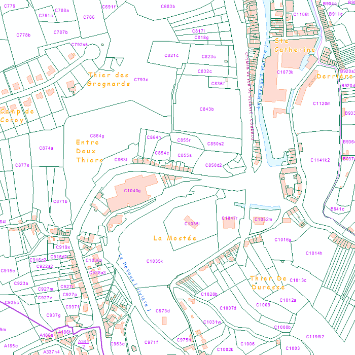
CadGIS Viewer is an application developed by the General Administration of Patrimonial Documentation of the FPS Finance. This application allows to:
- consult the current situation of the land register plan and the administrative units and print them out;
- consult all the tax situations since 2018 (situation as on 1 January) for the land register plan and administrative units;
- search and geolocate the objects on the land register plan on the basis of space characteristics or queries;
- ask for and print out cadastral plan parcels within a certain range around or adjacent to one or more parcels ;
- search graphically on the map for surveyors' plans (only for surveyors);
- add additional data to the map, both from a predefined list (IGN - Belgian national geographical institute’s aerial photographs, Cartoweb, regional reference frames such as GRB and PICC, ...) as well as other data via the URL of web services.
CadGIS Viewer est une application développée par l’Administration Générale de la Documentation Patrimoniale du SPF Finances. Cette application permet de :
- consulter la situation courante (actuelle) du plan parcellaire cadastral et des unités administratives ainsi que de les imprimer ;
- consulter l'ensemble des situations fiscales depuis 2018 (situation au 1e janvier) pour le plan parcellaire cadastral et les unités administratives ;
- rechercher et géolocaliser les objets du plan parcellaire cadastral sur base d’attributs ou de requêtes spatiales ;
- demander et imprimer des parcelles cadastrales plan dans un certain rayon autour ou adjacent à une ou plusieurs parcelles ;
- rechercher graphiquement sur la carte les plans de géomètres (uniquement pour les géomètres) ;
- ajouter des données supplémentaires à la carte, à la fois à partir d'une liste prédéfinie (photgraphies aériennes de l'IGN, Cartoweb, référentiels régionaux comme le GRB et le PICC, ...) ainsi que d'autres données via l'URL de services web.
CadGIS Viewer is een toepassing ontwikkeld door de Algemene Administratie van de Patrimoniumdocumentatie van de FOD Financiën. Met deze toepassing kunt u:
- De meest recente (actuele) toestand van het kadastraal percelenplan en de administratieve eenheden raadplegen en afdrukken;
- Alle fiscale toestanden sinds 2018 (toestand op 1 januari) van het kadastraal percelenplan en de administratieve eenheden raadplegen;
- Zoeken en geolokaliseren van de objecten van het kadastraal percelenplan op basis van attributen of ruimtelijke zoekopdrachten;
- kadastrale planpercelen binnen een bepaalde straal rond of grenzend aan één of meer percelen op te vragen en af te drukken;
- grafisch op de kaart zoeken naar landmetersplannen (alleen voor landmeters);
- toevoegen van extra gegevens aan de kaart, zowel uit een voorgedefinieerde lijst (NGI luchtfoto's, Cartoweb, regionale referentiebestanden zoals GRB en PICC, ...) als andere gegevens via de URL van webservices.
CadGIS Viewer ist eine Anwendung, die von der Generalverwaltung Vermögensdokumentation des FÖD Finanzen entwickelt wurde. Diese Anwendung ermöglicht es:
- den gegenwärten (aktuellen) Stand des Katasterplans und der Verwaltungseinheiten einzusehen und auszudrucken,
- alle Steuerlagen seit 2018 (Stand 1. Januar) für den Katasterplan und die Verwaltungseinheiten einzusehen,
- Objekte des Katasterplans anhand von räumlichen Attributen und Abfragen zu suchen und zu geolokalisieren,
- zweidimensionale Katasterparzellen innerhalb eines bestimmten Radius oder Katasterparzellen, die an eine oder mehrere Parzellen angrenzen, anzufordern und auszudrucken,
- Pläne von Landmessern grafisch auf der Karte zu suchen (nur für Landmesser),
-zusätzliche Daten zur Karte hinzuzufügen, sowohl aus einer vordefinierten Liste (Luftaufnahmen des Nationalen Geographischen Instituts, Cartoweb, regionale Referenzdateien wie GRB und PICC usw.) als auch andere Daten über die URL von Webdiensten.
Simple
-
Date (Création)Datum (creatie)Datumsangaben (Erstellung)Date (Creation)
- 2015-01-01
-
IdentificateurIdentifierIdentifikatorCitation identifier
- GAPD / a1a7e400-71eb-11eb-8a55-3448ed25ad7c
- Point of contact
-
Organisation name Individual name Electronic mail address Role FPS Finance - General Administration of Patrimonial Documentation (GAPD)
SPF Finances - Administration Générale de la Documentation Patrimoniale (AGDP)
FOD Financien - Algemene Administratie van de Patrimoniumdocumentatie (AAPD)
FOD Finanzen - Generalverwaltung Vermögensdokumentation (GVVD)
Gérald Henskens
GestionnairebeheerderVerwalterCustodian
-
Fréquence de mise à jourHerzieningsfrequentieÜberarbeitungsintervallMaintenance and update frequency
-
Lorsque nécessaireindien nodigBei BedarfAs needed
-
GEMET - INSPIRE themes, version 1.0
-
-
BuildingsBâtimentsGebouwenGebäude
-
BuildingsBâtimentsGebouwenGebäude
-
Geographical namesDénominations géographiquesGeografische namenGeografische Bezeichnungen
-
HydrographyHydrographieHydrografieGewässernetz
-
Cadastral parcelsParcelles cadastralesKadastrale percelenFlurstücke/Grundstücke (Katasterparzellen)
-
-
Contraintes d'utilisation(Juridische) gebruiksbeperkingNutzungseinschränkungenUse constraints
-
Autres restrictionsandersBenutzerdefinierte EinschränkungenOther restrictions
-
Other constraintsAutres contraintesOverige beperkingenAndere Einschränkungen
-
https://creativecommons.org/licenses/by/4.0/https://creativecommons.org/licenses/by/4.0/deed.frhttps://creativecommons.org/licenses/by/4.0/deed.nlhttps://creativecommons.org/licenses/by/4.0/deed.de
-
Contraintes d'accès(Juridische) toegangsrestrictieZugriffseinschränkungenAccess constraints
-
Autres restrictionsandersBenutzerdefinierte EinschränkungenOther restrictions
-
Other constraintsAutres contraintesOverige beperkingenAndere Einschränkungen
-
No limitations on public accessPas de restrictions concernant l'accès publicGeen beperkingen op openbare toegangÖffentliche Zugang nicht beschränkt
-
Other constraintsAutres contraintesOverige beperkingen
-
The licence is fully available in French ( https://finances.belgium.be/sites/default/files/Licence_plan_opendata_FR.PDF) or in Dutch ( https://financien.belgium.be/sites/default/files/Licentie_plan_opendata_NL.PDF).
Le contenu de la licence est intégrablement consultable ici : https://finances.belgium.be/sites/default/files/Licence_plan_opendata_FR.PDF.
de inhoud van de licentie is hier volledig doorzoekbaar: https://financien.belgium.be/sites/default/files/Licentie_plan_opendata_NL.PDF.
-
Type de serviceService TypeArt des DienstesService Type
- application
-
DescriptionDescriptionOmschrijvingBeschreibung
-
Belgium
Belgique
België
Belgien
))
- Coupled Resource
-
Operation Name Scoped name Identifier GetCapabilities
bc5418a7-bb6d-4d74-8af9-48fcae0bc299
-
Type de couplageCoupling typeArt der KopplungCoupling Type
-
ReserrétightEngTight
- Contains Operations
-
Operation Name Distributed Computing Platforms Connect Point https://eservices.minfin.fgov.be/ecad-web/#/
-
Ressource coupléeOperates onBezieht sich aufOperates On
Options de transfert numérique
Digitale leverings opties
Digitale Transferoptionen
Digital transfer options
- OnLine resource
-
Protocol Linkage Name WWW:LINK-1.0-http--link
https://eservices.minfin.fgov.be/ecad-web/#/
-
NiveauNiveau kwaliteitsbeschrijvingBezugsebeneHierarchy level
-
ServiceserviceServiceService
- Other
-
service
Cohérence du domaine de valeurs
Domain consistentie
Konsistenz des Wertebereichs
Domain consistency
-
Name of measureNom du testName of measureTestverfahren
-
INSPIRE Conformity
Conformité INSPIRE
INSPIRE Conformiteit
INSPIRE Konformität
Résultat de conformité
Resultaat conformiteit met de specificatie
Konformitätsergebnis
Conformance result
-
Date (Publication)Datum (publicatie)Datumsangaben (Publikation)Date (Publication)
- 2009-08-19
-
ExplanationExplicationUitlegErklärung
-
The service described does not meet the technical requirements as defined by the Commission Regulation (EC) No 976/2009 of 19 October 2009.
Le service décrit ne répond pas aux exigences techniques telles qu’elles sont définies par le Règlement (UE) n° 976/2009 de la Commission du 19 octobre 2009.
De beschreven service voldoet niet aan de technische vereisten zoals bepaald in de Verordening (EC) nr 976/2009 van de Commissie van 19 oktober 2009
Der beschriebene Dienst entspricht nicht den technischen Anforderungen wie bestimmt in der Verordnung (EG) Nr. 976/2009 der Kommission vom 19. Oktober 2009.
-
Degré de conformitéIndicatie van conformiteit met de specificatieBestandenPass
- No
Metadata
-
Identifiant de la ficheMetadata IDMetadatensatzidentifikatorFile identifier
- a1a7e400-71eb-11eb-8a55-3448ed25ad7c XML
-
LangueTaalSpracheMetadata language
- English
-
Jeu de caractèresKaraktersetZeichensatzCharacter set
-
Utf8utf8Utf8UTF8
-
Type de ressourceHierarchisch niveauHierarchieebeneHierarchy level
-
interactiveMapinteractiveMapinteractiveMapinteractiveMap
- Hierarchy level name
-
Application
-
Date des métadonnéesMetadata datumDatumDate stamp
- 2026-09-25T11:24:44
-
Metadata standard name
-
ISO 19115:2003/19139
- Metadata standard version
-
1.0
- Metadata author
-
Organisation name Individual name Electronic mail address Role FPS Finance - General Administration of Patrimonial Documentation (GAPD)
SPF Finances - Administration Générale de la Documentation Patrimoniale (AGDP)
FOD Financien - Algemene Administratie van de Patrimoniumdocumentatie (AAPD)
FOD Finanzen - Generalverwaltung Vermögensdokumentation (GVVD)
Gérald Henskens
Point de contactcontactpuntAnsprechpartnerPoint of contact
- Other language
-
Language Character encoding FrançaisFransFranzösischFrenchNéerlandais; flamandNederlands; VlaamsNiederländischDutch; FlemishAllemandDuitsDeutschGermanAnglaisEngelsEnglischEnglishUtf8utf8Utf8UTF8