geo.be Metadata Catalog
Emergency rescue zones
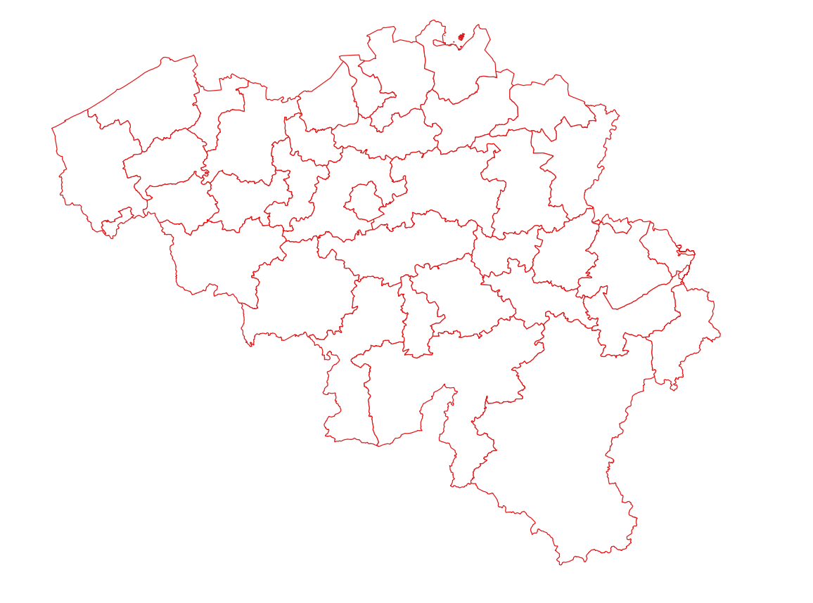
Emergency rescue zones corresponds to the dataset of the territorial delimitation of the emergency areas such as defined by the Royal Decree of February 2nd 2009 determining the territorial delimitation of the emergency areas in accordance with the law of May 15th 2007 on civil protection. This dataset is composed of two classes. The first class contains the identifiers, names and geometries of the various areas; the second is a class without geometry and corresponds to the table of Belgian municipalities with the emergency area for each of them. The dataset can be freely downloaded as a zipped shapefiles.
Simple
- Date (Creation)
- 2022-06-15
- Date (Revision)
- 2026-06-18
- Citation identifier
- GADP / 69e433cf-e89f-11ec-8ae3-9453308970f2
- Status
- Completed
- Point of contact
-
Organisation name Individual name Electronic mail address Role FPS Finance - General Administration of Patrimonial Documentation (GAPD)
Gérald Henskens
Custodian
- Maintenance and update frequency
- Annually
- Use constraints
- Other restrictions
- Other constraints
- https://creativecommons.org/licenses/by/4.0/
- Access constraints
- Other restrictions
- Other constraints
- No limitations on public access
- Spatial representation type
- Vector
- Denominator
- 10000
- Language
- Deutsch
- Language
- Français
- Language
- Nederlands; Vlaams
- Language
- English
- Character set
- 8859 Part 15
- Description
-
Belgium
))
- Distribution format
-
Name Version Esri Shapefile 10.2
Digital transfer options
- OnLine resource
-
Protocol Linkage Name WWW:LINK-1.0-http--link
http://www.ejustice.just.fgov.be/eli/besluit/2009/02/02/2009000065/justel http://www.ejustice.just.fgov.be/eli/besluit/2009/02/02/2009000065/justel
WWW:LINK-1.0-http--link
https://opendata.fin.belgium.be/download/TechnicalSpecifications/EmergencyRescueZones_20260618_TechSpec_NL.pdf WWW:LINK-1.0-http--link
https://opendata.fin.belgium.be/download/ATOM/9bb31275-18bc-4bdc-96e9-55c9e1edd9eb-en.xml Download service non-INSPIRE datasets
Digital transfer options
- OnLine resource
-
Protocol Linkage Name WWW:DOWNLOAD-1.0-http--download
https://opendata.fin.belgium.be/download/datasets/69bf46b0-e89f-11ec-a74a-9453308970f2_20260618_shp_3812_01000.zip
Digital transfer options
- OnLine resource
-
Protocol Linkage Name WWW:DOWNLOAD-1.0-http--download
https://opendata.fin.belgium.be/download/datasets/69bf46b0-e89f-11ec-a74a-9453308970f2_20260618_shp_31370_01000.zip
Digital transfer options
- OnLine resource
-
Protocol Linkage Name WWW:DOWNLOAD-1.0-http--download
https://financien.belgium.be/nl/experten_partners/open-patrimoniumdata/datasets/downloadportaal https://finance.belgium.be/en/experts-partners/open-data-patrimony/datasets/download-portal
- Hierarchy level
- Dataset
Domain consistency
- Name of measure
-
INSPIRE Conformity
Conformance result
- Date (Publication)
- 2010-12-08
- Explanation
-
The dataset’s compliance with the technical requirements as defined by the Commission Regulation (EU) No 1089/2010 of 23 November 2010 has not been checked
- Statement
-
Emergency rescue zones is constituted on the basis of the Royal Decree of February 2nd 2009 determining the territorial delimitation of the emergency areas, which describes and establishes the municipalities belonging to each area. The delimitation of emergency areas is then reconstituted by the General Administration of Patrimonial Documentation by merging the geometries of municipalities in the same area. The municipalities’ geometry corresponds to the one of the Administrative Units dataset– situation on January 1st.
Metadata
- File identifier
- 69bf46b0-e89f-11ec-a74a-9453308970f2 XML
- Metadata language
- English
- Character set
- UTF8
- Hierarchy level
- Dataset
- Date stamp
- 2026-09-16T09:16:37
- Metadata standard name
-
ISO 19115:2003/19139
- Metadata standard version
-
1.0
- Metadata author
-
Organisation name Individual name Electronic mail address Role FPS Finance - General Administration of Patrimonial Documentation (GAPD)
Gérald Henskens
Point of contact
- Other language
-
Language Character encoding French Dutch; Flemish German English UTF8