geo.be Metadata Catalog
Administrative units and Land register plan - current situation (WMS)
Unités administratives et Plan parcellaire cadastral – situation courante (WMS)
Administratieve eenheden en Kadastraal Percelenplan - actuele toestand (WMS)
Verwaltungseinheiten und Katasterplan – gegenwärtiger Stand (WMS)
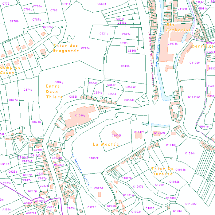
This web service provides the display of the datasets Administrative units - current situation and Land register plan - current situation. This webservice does not comply with the INSPIRE specifications, and the datasets to which it gives access do not comply with the INSPIRE specifications. This web service is available in several formats. It is recommended to use the PNG format.
Ce service web assure la visualisation des jeux de données Unités administratives – situation courante et Plan parcellaire parcellaire – situation courante . Ce service web n'est pas conforme aux spécifications INSPIRE, et les jeux de données auxquels ils donnent accès ne sont pas conformes aux spécifications INSPIRE. Ce service web est disponible en plusieurs formats. Il est recommandé d'utiliser le format PNG.
Deze webservice verzekert het downloaden per object van de dataset Administratiee eenheden - actuele toestand en Kadastraal Percelenplan - actuele toestand. Deze webservice is niet in overeenstemming met de INSPIRE-specificaties, en de datasets waarnaar ze toegang verlenen zijn niet conform aan de INSPIRE-specificaties. Deze webdienst is beschikbaar in verschillende formaten. Het wordt aanbevolen het PNG-formaat te gebruiken.
Dieser Webdienst ermöglicht die Darstellung der Datensätze Verwaltungseinheiten – gegenwärtiger Stand und Katasterplan – gegenwärtiger Stand. Dieser Webdienst erfüllt die INSPIRE-Anforderungen nicht, und die Datensätze, auf die er Zugriff gewährt, entsprechen diesen Vorgaben nicht. Dieser Webdienst ist in verschiedenen Formaten verfügbar. Es wird empfohlen, das PNG-Format zu verwenden.
Simple
-
Date (Création)Datum (creatie)Datumsangaben (Erstellung)Date (Creation)
- 2017-01-01T12:00:00
-
Date (Révision)Datum (revisie)Datumsangaben (Überarbeitung)Date (Revision)
- 2018-01-01
- Point of contact
-
Organisation name Individual name Electronic mail address Role FPS Finance - General Administration of Patrimonial Documentation (GAPD)
SPF Finances - Administration Générale de la Documentation Patrimoniale (AGDP)
FOD Financien - Algemene Administratie van de Patrimoniumdocumentatie (AAPD)
FOD Finanzen - Generalverwaltung Vermögensdokumentation (GVVD)
Gérald Henskens
Point de contactcontactpuntAnsprechpartnerPoint of contact
-
ThèmethemeThemaTheme
-
-
humanGeographicViewer
-
-
GEMET - Concept themes, version 4.01
-
-
national boundaryfrontière nationalelandsgrensStaatsgrenze
-
land and property registercadastreeigendomsregisterGrundbuch
-
buildingbâtimentgebouwGebäude
-
sub-national boundaryfrontière infranationalebinnengrensInnerstaatliche Grenze
-
public serviceservice publicnutsbedrijfÖffentliche Dienste
-
federal governmentgouvernement fédéralfederale regeringBundesregierung
-
- Keywords
-
-
Federal viewer
-
-
Contraintes d'utilisation(Juridische) gebruiksbeperkingNutzungseinschränkungenUse constraints
-
Autres restrictionsandersBenutzerdefinierte EinschränkungenOther restrictions
-
Other constraintsAutres contraintesOverige beperkingenAndere Einschränkungen
-
https://creativecommons.org/licenses/by/4.0/https://creativecommons.org/licenses/by/4.0/deed.frhttps://creativecommons.org/licenses/by/4.0/deed.nlhttps://creativecommons.org/licenses/by/4.0/deed.de
-
Contraintes d'accès(Juridische) toegangsrestrictieZugriffseinschränkungenAccess constraints
-
Autres restrictionsandersBenutzerdefinierte EinschränkungenOther restrictions
-
Other constraintsAutres contraintesOverige beperkingenAndere Einschränkungen
-
No limitations on public accessPas de restrictions concernant l'accès publicGeen beperkingen op openbare toegangÖffentliche Zugang nicht beschränkt
-
Type de serviceService TypeArt des DienstesService Type
- view
- Service Version
-
1.3.0
- Fees
-
NONE
))
- Coupled Resource
-
Operation Name Scoped name Identifier GetCapabilities
65132770-71dc-11eb-b166-3448ed25ad7c
GetCapabilities
63b98ade-71dc-11eb-8bf5-3448ed25ad7c
-
Type de couplageCoupling typeArt der KopplungCoupling Type
-
LibrelooseLoseLoose
- Contains Operations
-
Operation Name Distributed Computing Platforms Connect Point GetCapabilities
WebServicesWebServicesWebServicesWeb serviceshttp://ccff02.minfin.fgov.be/geoservices/arcgis/services/WMS/Cadastral_Layers/MapServer/WMSServer? GetMap
WebServicesWebServicesWebServicesWeb serviceshttp://ccff02.minfin.fgov.be/geoservices/arcgis/services/WMS/Cadastral_Layers/MapServer/WMSServer?
-
Ressource coupléeOperates onBezieht sich aufOperates On
-
Type de géométries des objetsGeometrisch objecttypeGeometrietypGeometric object type
-
PolygonesurfaceFlächeSurface
- Distribution format
-
Name Version bmp
1.0
jpeg
1.0
tiff
1.0
png
1.0
gif
1.0
Options de transfert numérique
Digitale leverings opties
Digitale Transferoptionen
Digital transfer options
- OnLine resource
-
Protocol Linkage Name OGC:WMS
https://ccff02.minfin.fgov.be/geoservices/arcgis/services/WMS/Cadastral_Layers/MapServer/WMSServer?request=GetCapabilities&service=WMS
-
NiveauNiveau kwaliteitsbeschrijvingBezugsebeneHierarchy level
-
ServiceserviceServiceService
- Other
-
Webmap service
Cohérence du domaine de valeurs
Domain consistentie
Konsistenz des Wertebereichs
Domain consistency
-
Name of measureNom du testName of measureTestverfahren
-
INSPIRE Conformity
Conformité INSPIRE
INSPIRE Conformiteit
INSPIRE Konformität
Résultat de conformité
Resultaat conformiteit met de specificatie
Konformitätsergebnis
Conformance result
-
Date (Publication)Datum (publicatie)Datumsangaben (Publikation)Date (Publication)
- 2009-08-19
-
ExplanationExplicationUitlegErklärung
-
The service described meets the technical requirements as defined by the Commission Regulation (EC) No 976/2009 of 19 October 2009
Le service décrit répond aux exigences techniques telles qu’elles sont définies par le Règlement (UE) n° 976/2009 de la Commission du 19 octobre 2009
De beschreven service voldoet aan de technische vereisten zoals bepaald in de Verordening (EC) nr 976/2009 van de Commissie van 19 oktober 2009
Der beschriebene Dienst entspricht den technischen Anforderungen wie bestimmt in der Verordnung (EG) Nr. 976/2009 der Kommission vom 19. Oktober 2009
-
Degré de conformitéIndicatie van conformiteit met de specificatieBestandenPass
- No
Metadata
-
Identifiant de la ficheMetadata IDMetadatensatzidentifikatorFile identifier
- 1bfe33a9-9fd5-47e4-85bd-d56072f9888e XML
-
LangueTaalSpracheMetadata language
- English
-
Jeu de caractèresKaraktersetZeichensatzCharacter set
-
Utf8utf8Utf8UTF8
-
Type de ressourceHierarchisch niveauHierarchieebeneHierarchy level
-
ServiceserviceServiceService
- Hierarchy level name
-
Webmap service
-
Date des métadonnéesMetadata datumDatumDate stamp
- 2026-09-24T15:43:56
-
Metadata standard name
-
ISO 19115:2003/19139
- Metadata standard version
-
1.0
- Metadata author
-
Organisation name Individual name Electronic mail address Role FPS Finance - General Administration of Patrimonial Documentation (GAPD)
SPF Finances - Administration Générale de la Documentation Patrimoniale (AGDP)
FOD Financien - Algemene Administratie van de Patrimoniumdocumentatie (AAPD)
FOD Finanzen - Generalverwaltung Vermögensdokumentation (GVVD)
Gérald Henskens
Point de contactcontactpuntAnsprechpartnerPoint of contact
- Other language
-
Language Character encoding FrançaisFransFranzösischFrenchNéerlandais; flamandNederlands; VlaamsNiederländischDutch; FlemishAllemandDuitsDeutschGermanAnglaisEngelsEnglischEnglishUtf8utf8Utf8UTF8