 geo.be Metadata Catalog
MapIndex
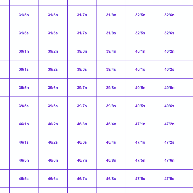
MapIndex is een regelmatig rooster met rechthoekige en vierkante cellen die gecodeerd zijn volgens alfanumerieke karakters. Het is bepaald voor het Belgische grondgebied en er kunnen verschillende gebeurtenissen mee gegeolokaliseerd worden. De versie die we hier voorstellen is een betaversie (v2) die wordt voorgelegd aan de hulpdiensten. Op termijn zal ze evolueren en een standaard cartografisch rooster worden.
Standaard
- Datum (creatie)
- 2020-08-06
- Datum (revisie)
- 2023-11-13
- Identifier
- BE.NGI-IGN / 0df5cb5e-04c6-11eb-a1e3-186571a04de3
- Status
- compleet
- Contactgegevens voor de data
-
Organisatie Naam Contactpersoon Email Rol Nationaal Geografisch Instituut
Frédérique Spitaels
beheerder
- Herzieningsfrequentie
- niet gepland
- Trefwoorden
-
-
Federal viewer
-
HVD_cat_area_management, HVD_cat_restrictions, HVD_cat_regulation_zones, HVD_cat_reporting_units
-
- (Juridische) gebruiksbeperking
- anders
- Overige beperkingen
- https://creativecommons.org/licenses/by/4.0/deed.nl
- (Juridische) toegangsrestrictie
- anders
- Overige beperkingen
- Geen beperkingen op openbare toegang
- Gebruiksbeperkingen
- https://creativecommons.org/licenses/by/4.0/deed.nl
- Ruimtelijk schema
- vector
- Toepassingsschaal
- 10000
- Taal
- Deutsch
- Taal
- Nederlands; Vlaams
- Taal
- Français
- Taal
- English
- Karakterset
- 8859part15
- Onderwerp
-
- nutsbedrijven communicatie
- Omschrijving
-
België
))
- Distributie formaat
Digitale leverings opties
- OnLine bronnen
-
Protocol URL Naam WWW:DOWNLOAD-1.0-http--download
https://ac.ngi.be/remoteclient-open/ngi-standard-open/Vectordata/MapIndex/0df5cb5e-04c6-11eb-a1e3-186571a04de3_x-filegdb_4326.zip WWW:LINK-1.0-http--link
https://ac.ngi.be/remoteclient-open/ngi-standard-open/Specifications/Vectordata/mapindex_BETAv2_ProductSpecification_FR.pdf WWW:LINK-1.0-http--link
https://wfs.ngi.be/inspire/mapindex/service?request=GetCapabilities&service=WFS&version=1.3.0 MapIndex
Digitale leverings opties
- OnLine bronnen
-
Protocol URL Naam WWW:DOWNLOAD-1.0-http--download
https://ac.ngi.be/remoteclient-open/ngi-standard-open/Vectordata/MapIndex/0df5cb5e-04c6-11eb-a1e3-186571a04de3_geopackage+sqlite3_4326.zip
Digitale leverings opties
- OnLine bronnen
-
Protocol URL Naam WWW:DOWNLOAD-1.0-http--download
https://ac.ngi.be/remoteclient-open/ngi-standard-open/Vectordata/MapIndex/0df5cb5e-04c6-11eb-a1e3-186571a04de3_x-shapefile_4326.zip
Digitale leverings opties
- OnLine bronnen
-
Protocol URL Naam WWW:DOWNLOAD-1.0-http--download
https://ac.ngi.be/remoteclient-open/ngi-standard-open/Vectordata/MapIndex/0df5cb5e-04c6-11eb-a1e3-186571a04de3_gml+xml_4326.zip
Digitale leverings opties
- OnLine bronnen
-
Protocol URL Naam WWW:DOWNLOAD-1.0-http--download
https://ac.ngi.be/remoteclient-open/ngi-standard-open/Vectordata/MapIndex/0df5cb5e-04c6-11eb-a1e3-186571a04de3_x-filegdb_3857.zip
Digitale leverings opties
- OnLine bronnen
-
Protocol URL Naam WWW:DOWNLOAD-1.0-http--download
https://ac.ngi.be/remoteclient-open/ngi-standard-open/Vectordata/MapIndex/0df5cb5e-04c6-11eb-a1e3-186571a04de3_geopackage+sqlite3_3857.zip
Digitale leverings opties
- OnLine bronnen
-
Protocol URL Naam WWW:DOWNLOAD-1.0-http--download
https://ac.ngi.be/remoteclient-open/ngi-standard-open/Vectordata/MapIndex/0df5cb5e-04c6-11eb-a1e3-186571a04de3_x-shapefile_3857.zip
Digitale leverings opties
- OnLine bronnen
-
Protocol URL Naam WWW:DOWNLOAD-1.0-http--download
https://ac.ngi.be/remoteclient-open/ngi-standard-open/Vectordata/MapIndex/0df5cb5e-04c6-11eb-a1e3-186571a04de3_gml+xml_3857.zip
Digitale leverings opties
- OnLine bronnen
-
Protocol URL Naam WWW:DOWNLOAD-1.0-http--download
https://ac.ngi.be/remoteclient-open/ngi-standard-open/Vectordata/MapIndex/0df5cb5e-04c6-11eb-a1e3-186571a04de3_x-filegdb_25832.zip
Digitale leverings opties
- OnLine bronnen
-
Protocol URL Naam WWW:DOWNLOAD-1.0-http--download
https://ac.ngi.be/remoteclient-open/ngi-standard-open/Vectordata/MapIndex/0df5cb5e-04c6-11eb-a1e3-186571a04de3_geopackage+sqlite3_25832.zip
Digitale leverings opties
- OnLine bronnen
-
Protocol URL Naam WWW:DOWNLOAD-1.0-http--download
https://ac.ngi.be/remoteclient-open/ngi-standard-open/Vectordata/MapIndex/0df5cb5e-04c6-11eb-a1e3-186571a04de3_x-shapefile_25832.zip
Digitale leverings opties
- OnLine bronnen
-
Protocol URL Naam WWW:DOWNLOAD-1.0-http--download
https://ac.ngi.be/remoteclient-open/ngi-standard-open/Vectordata/MapIndex/0df5cb5e-04c6-11eb-a1e3-186571a04de3_gml+xml_25832.zip
Digitale leverings opties
- OnLine bronnen
-
Protocol URL Naam WWW:DOWNLOAD-1.0-http--download
https://ac.ngi.be/remoteclient-open/ngi-standard-open/Vectordata/MapIndex/0df5cb5e-04c6-11eb-a1e3-186571a04de3_x-filegdb_25831.zip
Digitale leverings opties
- OnLine bronnen
-
Protocol URL Naam WWW:LINK-1.0-http--link
https://ac.ngi.be/remoteclient-open/ngi-standard-open/Vectordata/MapIndex/0df5cb5e-04c6-11eb-a1e3-186571a04de3_geopackage+sqlite3_25831.zip MapIndex-geopackage-utm31n
Digitale leverings opties
- OnLine bronnen
-
Protocol URL Naam WWW:DOWNLOAD-1.0-http--download
https://ac.ngi.be/remoteclient-open/ngi-standard-open/Vectordata/MapIndex/0df5cb5e-04c6-11eb-a1e3-186571a04de3_x-shapefile_25831.zip
Digitale leverings opties
- OnLine bronnen
-
Protocol URL Naam WWW:DOWNLOAD-1.0-http--download
https://ac.ngi.be/remoteclient-open/ngi-standard-open/Vectordata/MapIndex/0df5cb5e-04c6-11eb-a1e3-186571a04de3_gml+xml_25831.zip
Digitale leverings opties
- OnLine bronnen
-
Protocol URL Naam WWW:DOWNLOAD-1.0-http--download
https://ac.ngi.be/remoteclient-open/ngi-standard-open/Vectordata/MapIndex/0df5cb5e-04c6-11eb-a1e3-186571a04de3_x-filegdb_3812.zip 0df5cb5e-04c6-11eb-a1e3-186571a04de3_x-filegdb_3812.zip
Digitale leverings opties
- OnLine bronnen
-
Protocol URL Naam WWW:DOWNLOAD-1.0-http--download
https://ac.ngi.be/remoteclient-open/ngi-standard-open/Vectordata/MapIndex/0df5cb5e-04c6-11eb-a1e3-186571a04de3_geopackage+sqlite3_3812.zip 0df5cb5e-04c6-11eb-a1e3-186571a04de3_geopackage+sqlite3_3812.zip
Digitale leverings opties
- OnLine bronnen
-
Protocol URL Naam WWW:DOWNLOAD-1.0-http--download
https://ac.ngi.be/remoteclient-open/ngi-standard-open/Vectordata/MapIndex/0df5cb5e-04c6-11eb-a1e3-186571a04de3_x-shapefile_3812.zip 0df5cb5e-04c6-11eb-a1e3-186571a04de3_x-shapefile_3812.zip
Digitale leverings opties
- OnLine bronnen
-
Protocol URL Naam WWW:DOWNLOAD-1.0-http--download
https://ac.ngi.be/remoteclient-open/ngi-standard-open/Vectordata/MapIndex/0df5cb5e-04c6-11eb-a1e3-186571a04de3_gml+xml_3812.zip 0df5cb5e-04c6-11eb-a1e3-186571a04de3_gml+xml_3812.zip
Digitale leverings opties
- OnLine bronnen
-
Protocol URL Naam OGC:WMS
https://wms.ngi.be/inspire/mapindex/service?service=wms&request=getcapabilities&version=1.3.0
- Niveau kwaliteitsbeschrijving
- dataset
Domain consistentie
- Name of measure
-
INSPIRE Conformiteit
Resultaat conformiteit met de specificatie
- Datum (publicatie)
- 2010-12-08
- Uitleg
-
De overeenstemming van de dataset met de technische vereisten zoals bepaald in de Verordening (EU) nr 1089/2010 van de Commissie van 23 november 2010 werd niet gecontroleerd
- Algemene beschrijving herkomst
-
Standaard cartografische index (betaversie) op twee niveaus:
-Het eerste komt overeen met de standaard kaartversnijding van het NGI voor de schaal 1:10 000 ( 8km x 5km).
-Het tweede bestaat uit cellen met een zijde van 500 meter, met een code die bestaat uit een letter en een cijfer.
Metadata
- Metadata ID
- 0df5cb5e-04c6-11eb-a1e3-186571a04de3 XML
- Taal
- English
- Karakterset
- utf8
- Hierarchisch niveau
- dataset
- Metadata datum
- 2026-01-27T12:05:47
- Metadata standaard naam.
-
ISO 19115:2003/19139
- Metadata standaard versie
-
1.0
- Metadata auteur
-
Organisatie Naam Contactpersoon Email Rol Nationaal Geografisch Instituut
Floor Van Damme
contactpunt
- Landinstelling
-
Taalcode Tekencodering Frans Nederlands; Vlaams Duits Engels utf8