geo.be Metadata Catalog
Territorial Divisions
Territorial Divisions
Territorial Divisions
Territorial Divisions
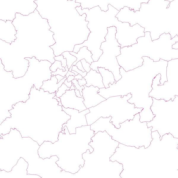
Territorial Divisions is the vectorproduct representing the geographical units of Belgium. The product consists of 16 feature types grouped into 4 topics: ‘AdminVector’, ‘Judicial cantons and arrondissements’, ‘Electoral cantons’ and ‘Postal cantons’.
The AdminVector dataset includes the statistical, geographical and administrative units of Belgium.
The dataset of the judicial cantons and arrondissements displays the geographical units used for the organisation of the courts.
The dataset of the electoral cantons consists of geographical units used for the organisation of elections.
The dataset of the postal cantons includes the boundaries of the Belgian postal cantons.
The product can be downloaded in its entirety via the links in 'Access' at the bottom of this page. Each of the themes is also available as separate datasets on their own webpage.
Territorial Divisions est le produit vectoriel représentant les unités géographiques de la Belgique. Il se compose de 16 types d'objets regroupés en quatre thèmes: ‘AdminVector’, ‘Cantons et arrondissements judiciaires’, ‘Cantons électoraux’ et ‘Cantons postaux’.
Le jeu de données AdminVector inclut les unités statistiques, géographiques et administratives de la Belgique.
Le jeu de données des cantons et arrondissements judiciaires représente les unités géographiques utilisées pour l'organisation des tribunaux.
Le jeu de données des cantons électoraux comprend les unités géographiques utilisées pour l'organisation des élections.
Le jeu de données des cantons postaux inclut les limites des cantons postaux belges.
Le produit peut être téléchargé dans son intégralité via les liens de la section ‘Accès’ en bas de cette page. Chacun de ces thèmes est disponible sous forme de jeu de données distinct sur sa propre page web.
Territorial Divisions is het vectorproduct dat de geografische eenheden vertegenwoordigt van België. Het product bestaat uit 16 objecttypes gegroepeerd in vier thema’s: ‘AdminVector’, ‘Gerechtelijke kantons en arrondissementen’, ‘Kieskantons’ en ‘Postkantons.
De dataset AdminVector omvat de statistische, geografische en administratieve eenheden van België.
De dataset met de gerechtelijke kantons en arrondissementen geeft de geografische eenheden weer die worden gebruikt voor de organisatie van de rechtbanken.
De dataset van de kieskantons bestaat uit de geografische eenheden die worden gebruikt voor de organisatie van de verkiezingen.
De dataset met de postkantons omvat de grenzen van de Belgische postkantons.
Het product kan integraal worden gedownload via de links in 'Toegang' onderaan deze pagina. Elk van deze thema’s zijn ook als aparte datasets verkrijgbaar op hun eigen webpagina.
Territorial Divisions ist ein Vektorprodukt, das die geografischen Einheiten Belgiens repräsentiert. Es besteht aus 16 Objekttypen, die in vier Themenbereiche unterteilt sind: ‘AdminVector’, ‘Gerichtskantone und Bezirke’, ‘Wahlkantone’ und ‘Postkantone’.
Der AdminVector-Datensatz umfasst die statistischen, geografischen und administrativen Einheiten Belgiens.
Der Datensatz der Gerichtskantone und Bezirke repräsentiert die geografischen Einheiten, die für die Organisation der Gerichte verwendet werden.
Der Datensatz der Wahlkantone besteht aus den geografischen Einheiten, die für die Organisation von Wahlen verwendet werden.
Der Datensatz der Postkantone enthält die Grenzen der belgischen Postkantone.
Das Produkt kann vollständig über die Links im Abschnitt ‘Zugriff’ am Ende dieser Seite heruntergeladen werden. Jedes dieser Themen ist auch als separater Datensatz auf einer eigenen Webseite verfügbar.
Simple
-
Date (Création)Datum (creatie)Datumsangaben (Erstellung)Date (Creation)
- 2022-03-30
-
Date (Révision)Datum (revisie)Datumsangaben (Überarbeitung)Date (Revision)
- 2026-07-16
-
IdentificateurIdentifierIdentifikatorCitation identifier
- BE.NGI-IGN / 1cd00540-b0ca-11ec-a863-186571a04de2
-
EtatStatusBearbeitungsstatusStatus
-
FinalisécompleetAbgeschlossenCompleted
- Point of contact
-
Organisation name Individual name Electronic mail address Role National Geographic Institute
Institut géographique national
Nationaal Geografisch Instituut
Nationales Geographisches Institut
David Robberechts
GestionnairebeheerderVerwalterCustodian
-
Fréquence de mise à jourHerzieningsfrequentieÜberarbeitungsintervallMaintenance and update frequency
-
Lorsque nécessaireindien nodigBei BedarfAs needed
- Keywords
-
-
HVD_cat_administrative units
HVD_cat_administrative units
HVD_cat_administrative units
HVD_cat_administrative units
-
-
Contraintes d'utilisation(Juridische) gebruiksbeperkingNutzungseinschränkungenUse constraints
-
Autres restrictionsandersBenutzerdefinierte EinschränkungenOther restrictions
-
Other constraintsAutres contraintesOverige beperkingenAndere Einschränkungen
-
https://creativecommons.org/licenses/by/4.0/https://creativecommons.org/licenses/by/4.0/deed.frhttps://creativecommons.org/licenses/by/4.0/deed.nlhttps://creativecommons.org/licenses/by/4.0/deed.de
-
Contraintes d'accès(Juridische) toegangsrestrictieZugriffseinschränkungenAccess constraints
-
Autres restrictionsandersBenutzerdefinierte EinschränkungenOther restrictions
-
Other constraintsAutres contraintesOverige beperkingenAndere Einschränkungen
-
No limitations on public accessPas de restrictions concernant l'accès publicGeen beperkingen op openbare toegangÖffentliche Zugang nicht beschränkt
-
Use limitationLimitation d'utilisationGebruiksbeperkingenAnwendungseinschränkungen
-
https://creativecommons.org/licenses/by/4.0/https://creativecommons.org/licenses/by/4.0/deed.frhttps://creativecommons.org/licenses/by/4.0/deed.nlhttps://creativecommons.org/licenses/by/4.0/deed.de
-
Type de représentation spatialeRuimtelijk schemaRäumliche DarstellungsartSpatial representation type
-
VecteurvectorVektorVector
-
Dénominateur de l'échelleToepassingsschaalMaßstabszahlDenominator
- 10000
-
Langue de la ressourceTaalSpracheLanguage
- Français
-
Langue de la ressourceTaalSpracheLanguage
- Nederlands; Vlaams
-
Encodage des caractèresKaraktersetZeichensatzCharacter set
-
8859part158859part158859part158859 Part 15
-
Catégorie ISOOnderwerpISO-ThematikTopic category
-
-
Limites politiques et administrativesgrenzenGrenzenBoundaries
-
-
DescriptionDescriptionOmschrijvingBeschreibung
-
Belgium
Belgique
België
Belgien
))
- Distribution format
-
Name Version GeoPackage1.3.0
Esri Shapefile10.2
Options de transfert numérique
Digitale leverings opties
Digitale Transferoptionen
Digital transfer options
- OnLine resource
-
Protocol Linkage Name WWW:DOWNLOAD-1.0-http--download
https://ac.ngi.be/remoteclient-open/ngi-standard-open/Vectordata/TerritorialDivisions/TerritorialDivisions-All/1cd00540-b0ca-11ec-a863-186571a04de2_geopackage+sqlite3_3812.zip
Options de transfert numérique
Digitale leverings opties
Digitale Transferoptionen
Digital transfer options
- OnLine resource
-
Protocol Linkage Name WWW:DOWNLOAD-1.0-http--download
https://ac.ngi.be/remoteclient-open/ngi-standard-open/Vectordata/TerritorialDivisions/TerritorialDivisions-All/1cd00540-b0ca-11ec-a863-186571a04de2_geopackage+sqlite3_4326.zip
Options de transfert numérique
Digitale leverings opties
Digitale Transferoptionen
Digital transfer options
- OnLine resource
-
Protocol Linkage Name WWW:DOWNLOAD-1.0-http--download
https://ac.ngi.be/remoteclient-open/ngi-standard-open/Vectordata/TerritorialDivisions/TerritorialDivisions-All/1cd00540-b0ca-11ec-a863-186571a04de2_x-shapefile_3812.zip
Options de transfert numérique
Digitale leverings opties
Digitale Transferoptionen
Digital transfer options
- OnLine resource
-
Protocol Linkage Name WWW:DOWNLOAD-1.0-http--download
https://ac.ngi.be/remoteclient-open/ngi-standard-open/Vectordata/TerritorialDivisions/TerritorialDivisions-All/1cd00540-b0ca-11ec-a863-186571a04de2_x-shapefile_4326.zip
Options de transfert numérique
Digitale leverings opties
Digitale Transferoptionen
Digital transfer options
- OnLine resource
-
Protocol Linkage Name WWW:LINK-1.0-http--link
https://ac.ngi.be/remoteclient-open/ngi-standard-open/Specifications/Vectordata/TerritorialDivisions_ProductSpecification_ENG.pdf OGC:WMS
https://data.geo.be/ws/territorialdivisions/wms?request=getcapabilities&service=wms
-
NiveauNiveau kwaliteitsbeschrijvingBezugsebeneHierarchy level
-
Jeu de donnéesdatasetDatenbestandDataset
Cohérence du domaine de valeurs
Domain consistentie
Konsistenz des Wertebereichs
Domain consistency
-
Name of measureNom du testName of measureTestverfahren
-
INSPIRE Conformity
Conformité INSPIRE
INSPIRE Conformiteit
INSPIRE Konformität
Résultat de conformité
Resultaat conformiteit met de specificatie
Konformitätsergebnis
Conformance result
-
Date (Publication)Datum (publicatie)Datumsangaben (Publikation)Date (Publication)
- 2010-12-08
-
ExplanationExplicationUitlegErklärung
-
The dataset’s compliance with the technical requirements as defined by the Commission Regulation (EU) No 1089/2010 of 23 November 2010 has not been checked
La conformité du jeu de donnée aux exigences techniques telles qu’elles sont définies par le Règlement (UE) n° 1089/2010 de la Commission du 23 novembre 2010 n'a pas été testée
De overeenstemming van de dataset met de technische vereisten zoals bepaald in de Verordening (EU) nr 1089/2010 van de Commissie van 23 november 2010 werd niet gecontroleerd
Die Kongruenz des Datensatzes mit den technischen Anforderungen wie bestimmt in der Verordnung (EG) Nr. 1089/2010 der Kommission vom 23. November 2010 wurde nicht geprüft
-
StatementGénéralités sur la provenanceAlgemene beschrijving herkomstErläuterung
-
AdminVector is updated annually with the authentic administrative data of the FPS Finance, except for the border markers and former municipalities. Based on this source and other relevant information, the postal cantons, electoral cantons and judicial districts were constructed according to their definition in their respective codes.
AdminVector est mis à jour annuellement avec les données administratives authentiques du SPF Finances, sauf pour les bornes frontières et les anciennes communes. Sur base de cette source et d'autres informations pertinentes, les cantons postaux, les cantons électoraux et les arrondissements judiciaires ont été construits selon leur définition dans leurs codes respectifs.
AdminVector wordt jaarlijks geüpdatet met de authentieke administratieve gegevens van de FOD Financiën, behalve de grenspalen en voormalige gemeenten. Op basis van deze bron en andere relevante informatie, werden de postkantons, kieskantons en gerechtelijke kantons en arrondissementen opgebouwd overeenkomstig hun definitie in hun respectievelijke wetboeken.
AdminVector wird jährlich mit den authentischen Verwaltungsdaten des FÖD Finanzen aktualisiert, mit Ausnahme der Grenzposten und ehemaligen Gemeinden. Auf der Grundlage dieser Quelle und anderer relevanter Informationen wurden die Postkantone, Wahlkantone und Gerichtskantone und -bezirke entsprechend ihrer Definition in den jeweiligen Gesetzbüchern gebildet.
Metadata
-
Identifiant de la ficheMetadata IDMetadatensatzidentifikatorFile identifier
- 1cd00540-b0ca-11ec-a863-186571a04de2 XML
-
LangueTaalSpracheMetadata language
- English
-
Jeu de caractèresKaraktersetZeichensatzCharacter set
-
Utf8utf8Utf8UTF8
-
Type de ressourceHierarchisch niveauHierarchieebeneHierarchy level
-
Jeu de donnéesdatasetDatenbestandDataset
-
Date des métadonnéesMetadata datumDatumDate stamp
- 2026-10-02T14:22:35
-
Metadata standard name
-
ISO 19115:2003/19139
- Metadata standard version
-
1.0
- Metadata author
-
Organisation name Individual name Electronic mail address Role National Geographic Institute
Institut géographique national
Nationaal Geografisch Instituut
Nationalen Geographischen Institut
Floor Van Damme
Point de contactcontactpuntAnsprechpartnerPoint of contact
- Other language
-
Language Character encoding FrançaisFransFranzösischFrenchNéerlandais; flamandNederlands; VlaamsNiederländischDutch; FlemishAllemandDuitsDeutschGermanAnglaisEngelsEnglischEnglishUtf8utf8Utf8UTF8