geo.be Metadata Catalog
RADCLIM
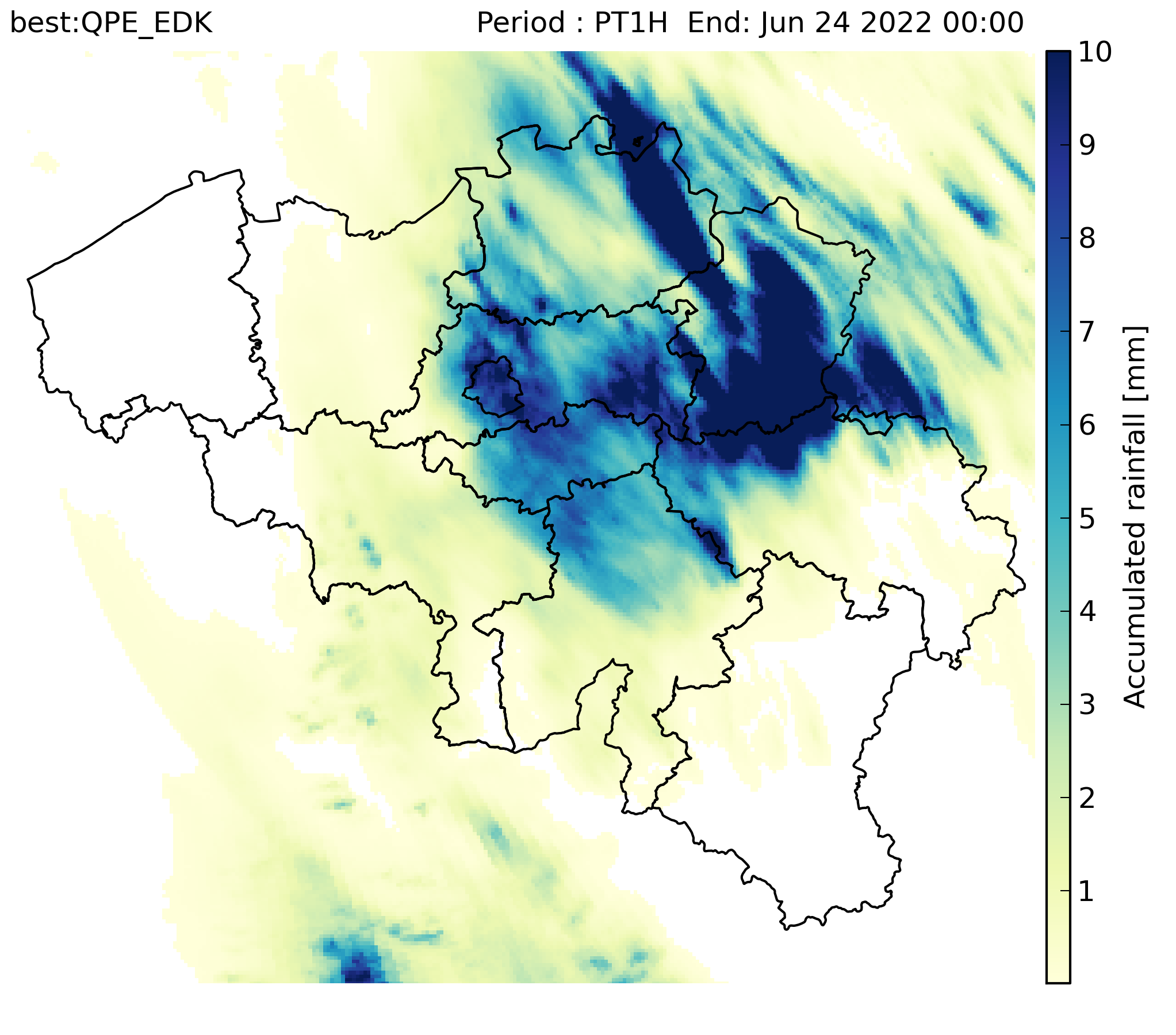
RADCLIM is a historical dataset based on weather radar observations that provides gridded accumulated precipitation composites over Belgium and surrounding regions. The data are distributed in ODIM_H5 version 2.2 format. The reported quantity is accumulated precipitation (ACRR) for 5-minute and 1-hour accumulation periods. UTC is used as the time reference, and the timestamp in the filename corresponds to the end of the accumulation period.
The dataset is produced on a 700 × 700 grid with 1 km spatial resolution in the Belgian Lambert 2008 projection (Lambert Conformal Conic).
Simple
- Date (Revision)
- 2024-03-14
- Citation identifier
- RMI-be / radclim
- Status
- Completed
- Point of contact
-
Organisation name Individual name Electronic mail address Role Royal Meteorological Institute of Belgium
Point of contact Royal Meteorological Institute of Belgium
Owner
- Maintenance and update frequency
- Continual
- User defined maintenance frequency
-
P0Y0M0DT0H5M0S
-
GEMET - INSPIRE themes, version 1.0
-
-
Meteorological geographical features
-
- Keywords
-
-
federal government
-
radclim
-
-
Spatial scope
- Access constraints
- Other restrictions
- Other constraints
- No limitations on public access
- Use constraints
- Other restrictions
- Classification
- Unclassified
- Spatial representation type
- Grid
- Distance
- 1000 m
- Language
- English
- Topic category
-
- Climatology, meteorology, atmosphere
))
- Begin date
- 2017-01-01T00:00:00
- End date
- 2022-12-31T00:00:00
- Unique resource identifier
- EPSG:4258
- Distribution format
-
Name Version ODIM H5
2.2
Digital transfer options
- OnLine resource
-
Protocol Linkage Name WWW:LINK-1.0-http--link
https://opendata.meteo.be
Digital transfer options
- OnLine resource
-
Protocol Linkage Name WWW:LINK-1.0-http--link
https://opendata.meteo.be/cases/202107/radclim_userguide.pdf
- Hierarchy level
- Dataset
- Other
-
dataset
Domain consistency
- Name of measure
-
INSPIRE Conformity
Conformance result
- Title
-
Commission Regulation (EU) No 1089/2010 of 23 November 2010 implementing Directive 2007/2/EC of the European Parliament and of the Council as regards interoperability of spatial data sets and services
- Date (Publication)
- 2010-12-08
- Explanation
-
See the referenced specification
- Pass
- No
- Statement
-
RADCLIM is derived from weather-radar reflectivity measurements by RMI software (RMIRADLIB2). The processing uses 3D reflectivity measurements from the radars in Wideumont and Jabbeke (RMI, Belgium), Helchteren (VMM, Belgium) and Avesnois (Météo-France, France), together with automatic rain-gauge observations from the Service Public de Wallonie (SPW), Vlaamse Milieumaatschappij (VMM), and Waterbouwkundig Laboratorium / Hydrologisch Informatiecentrum (WL/HIC) networks and provides gridded precipitation accumulations of 5 minutes and 1 hour. The 1-hour accumulation product is computed by summing consecutive 5-minute precipitation estimates.
The processing chain includes quality control of radar measurements, including handling of permanent contamination and beam blockage, as well as clutter identification using satellite cloudiness products, vertical profiles of reflectivity and image texture. Radar reflectivity is then converted to ground rainfall rate, missing data are interpolated, and radar information is merged into a composite product. Gauge information is incorporated through mean field bias correction and External Drift Kriging (EDK).
Metadata
- File identifier
- RMI_DATASET_RADCLIM XML
- Metadata language
- English
- Hierarchy level
- Dataset
- Date stamp
- 2026-03-10
- Metadata author
-
Organisation name Individual name Electronic mail address Role Royal Meteorological Institute of Belgium
Point of contact
- Other language
-
Language Character encoding French UTF8 Dutch; Flemish UTF8 German UTF8