 geo.be Metadata Catalog
CORINE High Resolution Layers (WMS)
CORINE High Resolution layers (WMS)
CORINE High Resolution Layers (WMS)
CORINE High Resolution Layers (WMS)
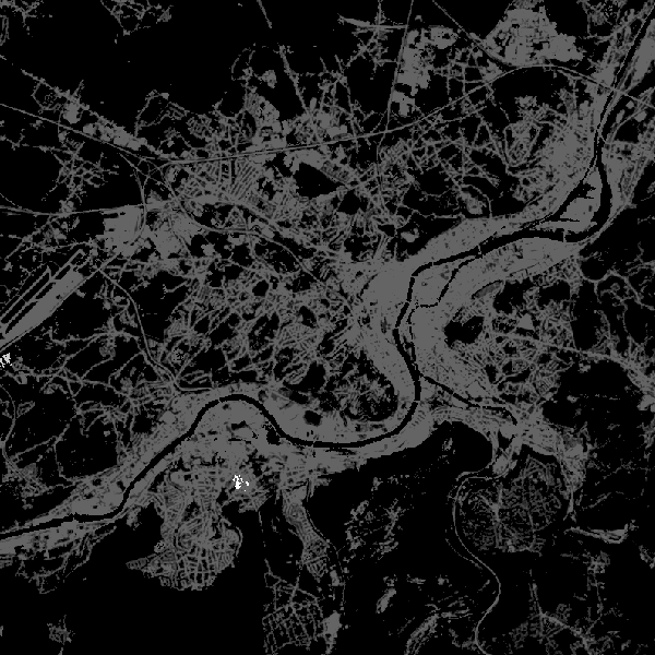
This web service allows viewing CORINE High Resolution Layers Belgium covering the Belgian territory within the framework of a Pan-European coverage. This service is compliant with the INSPIRE specifications.
Ce web-service assure la visualisation des données CORINE High Resolution Layers occupant le territoire belge dans le cadre d’une couverture paneuropé
Deze web-service verzekert de visualisatie van CORINE High Resolution Layers Belgium die het Belgische grondgebied overdekken in het kader van een pan-Europese overdekking. De dienst is conform met INSPIRE-specificaties.
Dieser Webservice sorgt für die Visualisierung CORINE High Resolution Layers die das belgische Landgebiet innerhalb von einer pan-europäischen Deckung abdecken. Der Service entspricht den INSPIRE-Spezifikationen.
Simple
-
Date (Publication)Datum (publicatie)Datumsangaben (Publikation)Date (Publication)
- 2014-07-09
-
Date (Révision)Datum (revisie)Datumsangaben (Überarbeitung)Date (Revision)
- 2022-06-28
-
IdentificateurIdentifierIdentifikatorCitation identifier
- BE.NGI-IGN / 8bdd5d37-a2aa-4015-8c6f-1f42b711242b
- Point of contact
-
Organisation name Individual name Electronic mail address Role National Geographic Institute
Institut géographique national
Nationaal Geografisch Instituut
Nationales geographisches Institut
GestionnairebeheerderVerwalterCustodian
-
Annex D4 of the European Commission Regulation 1205/2008
Annexe D4 du Règlement 1205/2008 de la Commission Européenne
Bijlage D4 van Verordening 1205/2008 van de Europese Commissie
Anhang D4 der Verordnung 1205/2008 der Europäischen Kommission
- Keywords
-
-
Federal viewer
-
-
Use limitationLimitation d'utilisationGebruiksbeperkingenAnwendungseinschränkungen
-
https://creativecommons.org/licenses/by/4.0/https://creativecommons.org/licenses/by/4.0/deed.frhttps://creativecommons.org/licenses/by/4.0/deed.nlhttps://creativecommons.org/licenses/by/4.0/deed.de
-
Contraintes d'accès(Juridische) toegangsrestrictieZugriffseinschränkungenAccess constraints
-
Autres restrictionsandersBenutzerdefinierte EinschränkungenOther restrictions
-
Other constraintsAutres contraintesOverige beperkingenAndere Einschränkungen
-
No limitations on public accessPas de restrictions concernant l'accès publicGeen beperkingen op openbare toegangÖffentliche Zugang nicht beschränkt
-
Contraintes d'utilisation(Juridische) gebruiksbeperkingNutzungseinschränkungenUse constraints
-
Autres restrictionsandersBenutzerdefinierte EinschränkungenOther restrictions
-
Other constraintsAutres contraintesOverige beperkingenAndere Einschränkungen
-
https://creativecommons.org/licenses/by/4.0/https://creativecommons.org/licenses/by/4.0/deed.frhttps://creativecommons.org/licenses/by/4.0/deed.nlhttps://creativecommons.org/licenses/by/4.0/deed.de
-
Type de serviceService TypeArt des DienstesService Type
- view
-
DescriptionDescriptionOmschrijvingBeschreibung
-
Belgium
Belgique
België
Belgien
))
- Coupled Resource
-
Operation Name Scoped name Identifier GetCapabilities
undefined fa872d13-77a0-4ada-8efb-1e13a8d51c57
GetCapabilities
undefined 8aa0a821-22f4-11e9-b82f-acb57d9e6f5a
-
Type de couplageCoupling typeArt der KopplungCoupling Type
-
ReserrétightEngTight
- Contains Operations
-
Operation Name Distributed Computing Platforms Connect Point GetCapabilities
WebServicesWebServicesWebServicesWeb serviceshttps://wms.ngi.be/inspire/hrl/service
-
Ressource coupléeOperates onBezieht sich aufOperates On
Options de transfert numérique
Digitale leverings opties
Digitale Transferoptionen
Digital transfer options
- OnLine resource
-
Protocol Linkage Name OGC:WMS
https://wms.ngi.be/inspire/hrl/service?request=GetCapabilities&service=WMS&version=1.3.0
-
NiveauNiveau kwaliteitsbeschrijvingBezugsebeneHierarchy level
-
ServiceserviceServiceService
- Other
-
Wemap service
Cohérence du domaine de valeurs
Domain consistentie
Konsistenz des Wertebereichs
Domain consistency
-
Name of measureNom du testName of measureTestverfahren
-
INSPIRE Conformity
Conformité INSPIRE
INSPIRE Conformiteit
INSPIRE Konformität
Résultat de conformité
Resultaat conformiteit met de specificatie
Konformitätsergebnis
Conformance result
-
Date (Publication)Datum (publicatie)Datumsangaben (Publikation)Date (Publication)
- 2009-08-19
-
ExplanationExplicationUitlegErklärung
-
The service described meets the technical requirements as defined by the Commission Regulation (EC) No 976/2009 of 19 October 2009
Le service décrit répond aux exigences techniques telles qu’elles sont définies par le Règlement (UE) n° 976/2009 de la Commission du 19 octobre 2009
De beschreven service voldoet aan de technische vereisten zoals bepaald in de Verordening (EC) nr 976/2009 van de Commissie van 19 oktober 2009
Der beschriebene Dienst entspricht den technischen Anforderungen wie bestimmt in der Verordnung (EG) Nr. 976/2009 der Kommission vom 19. Oktober 2009
-
Degré de conformitéIndicatie van conformiteit met de specificatieBestandenPass
- Yes
Metadata
-
Identifiant de la ficheMetadata IDMetadatensatzidentifikatorFile identifier
- 8bdd5d37-a2aa-4015-8c6f-1f42b711242b XML
-
LangueTaalSpracheMetadata language
- English
-
Jeu de caractèresKaraktersetZeichensatzCharacter set
-
Utf8utf8Utf8UTF8
-
Type de ressourceHierarchisch niveauHierarchieebeneHierarchy level
-
ServiceserviceServiceService
- Hierarchy level name
-
Webmap Service
-
Date des métadonnéesMetadata datumDatumDate stamp
- 2026-05-12T15:40:06
-
Metadata standard name
-
ISO 19115:2003/19139
- Metadata standard version
-
1.0
- Metadata author
-
Organisation name Individual name Electronic mail address Role National Geographic Institute
Institut géographique national
Nationaal Geografisch Instituut
Nationales geographisches Institut
Floor Van Damme
Point de contactcontactpuntAnsprechpartnerPoint of contact
- Other language
-
Language Character encoding FrançaisFransFranzösischFrenchNéerlandais; flamandNederlands; VlaamsNiederländischDutch; FlemishAllemandDuitsDeutschGermanAnglaisEngelsEnglischEnglishUtf8utf8Utf8UTF8