 geo.be Metadata Catalog
Historical orthophotos 2010s
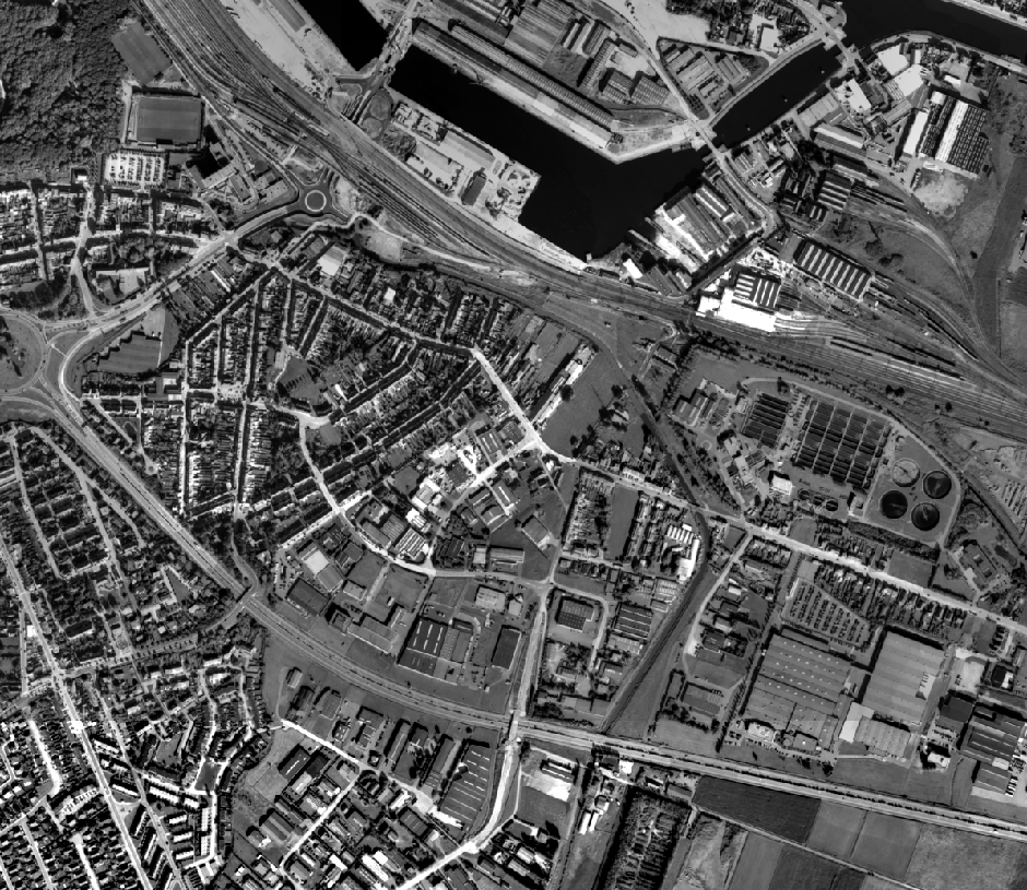
This dataset contains historical orthophoto mosaics based on available aerial photographs covering parts of the Belgian territory.
Orthophotos are aerial photographs that have been geometrically corrected (orthorectified) to eliminate distortions caused by terrain relief, lens distortion, and camera tilt. Unlike raw aerial imagery, orthophotos have a uniform scale and accurate geometry, making them suitable for cartography, measurements, and visual analysis.
This specific dataset includes historical orthophotos from 2010, 2011, 2012, 2013, 2014 and 2015, derived from aerial surveys carried out by the National Geographic Institute (NGI) and the Regions. During this period, both analogue and digital aerial photographs are available. The analogue images were scanned at high resolution and, like the digital ones, orthorectified. The resulting orthophotos were assembled into mosaics and georeferenced in the Lambert 2008 coordinate system.
All orthophotos are in colour (RGB). The ground resolution (GSD) varies between 10 cm and 50 cm, depending on the sensor used and the surveyed area. The spatial coverage of this dataset is limited to the areas for which aerial photographs were available during the mentioned period.
The data can be visualized via the corresponding web services (WMS/WMTS). The orthophotos and the original aerial photographs can be ordered in high resolution via https://shop.ngi.be/nl/luchtfotos/.
Simple
- Date (Creation)
- 2010-01-01
- Date (Publication)
- 2026-03-31
- Citation identifier
- BE.NGI-IGN / 2363a560-29ff-11f1-a24a-20c19bc9b64c
- Status
- Completed
- Point of contact
-
Organisation name Individual name Electronic mail address Role National Geographic Institute
Anke Bracke
Custodian
- Maintenance and update frequency
- As needed
- Keywords
-
-
historical orthophotos, aerial photographs, 2010, 2011, 2012, 2013, 2014, 2015, RGB, 10 cm resolution, 25 cm resolution, 50 cm resolution
-
- Use constraints
- Other restrictions
- Other constraints
-
•The custodian of the resource holds the rights of property (including the rights of intellectual property) to the geographic files
•The custodian grants the user the right to use the data for his internal use.
•Commercial use of the data under any form is strictly forbidden
•Custodian’s name must be mentioned each time the data are being used publically.
- Access constraints
- Other restrictions
- Other constraints
- No limitations on public access
- Use limitation
-
•The custodian of the resource holds the rights of property (including the rights of intellectual property) to the geographic files
•The custodian grants the user the right to use the data for his internal use.
•Commercial use of the data under any form is strictly forbidden
•Custodian’s name must be mentioned each time the data are being used publically.
- Spatial representation type
- Grid
- Distance
- 50 m
- Language
- Français
- Character set
- 8859 Part 15
- Topic category
-
- Imagery base maps earth cover
- Description
-
Belgium
))
- Unique resource identifier
- EPSG:3812
- Distribution format
-
Name Version TIFF
- Distributor contact
-
Organisation name Individual name Electronic mail address Role BE.NGI-IGN
Digital transfer options
- OnLine resource
-
Protocol Linkage Name OGC:WMTS
https://wmts.ngi.be/orthophotos_2010s/1.0.0/WMTSCapabilities.xml
Digital transfer options
Digital transfer options
Digital transfer options
- OnLine resource
-
Protocol Linkage Name WWW:LINK-1.0-http--link
https://ngi.be/aanbod/kaarten-en-fotos/luchtfotos-orthofotos/ https://ngi.be/aanbod/kaarten-en-fotos/luchtfotos-orthofotos/
Digital transfer options
- OnLine resource
-
Protocol Linkage Name OGC:WMS https://wms.ngi.be/orthophotos_2010s/service?service=wms&version=1.3.0&request=getcapabilities
- Hierarchy level
- Dataset
Domain consistency
- Name of measure
-
INSPIRE Conformity
Conformance result
- Date (Publication)
- 2010-12-08
- Explanation
-
The dataset’s compliance with the technical requirements as defined by the Commission Regulation (EU) No 1089/2010 of 23 November 2010 has not been checked
- Statement
-
A compléter
Metadata
- File identifier
- 2363a560-29ff-11f1-a24a-20c19bc9b64c XML
- Metadata language
- English
- Character set
- UTF8
- Hierarchy level
- Dataset
- Date stamp
- 2026-06-10T13:11:09
- Metadata standard name
-
ISO 19115:2003/19139
- Metadata standard version
-
1.0
- Metadata author
-
Organisation name Individual name Electronic mail address Role National Geographic Institute
Floor Van Damme
Point of contact
- Other language
-
Language Character encoding French Dutch; Flemish German English UTF8