geo.be Metadata Catalog
POI
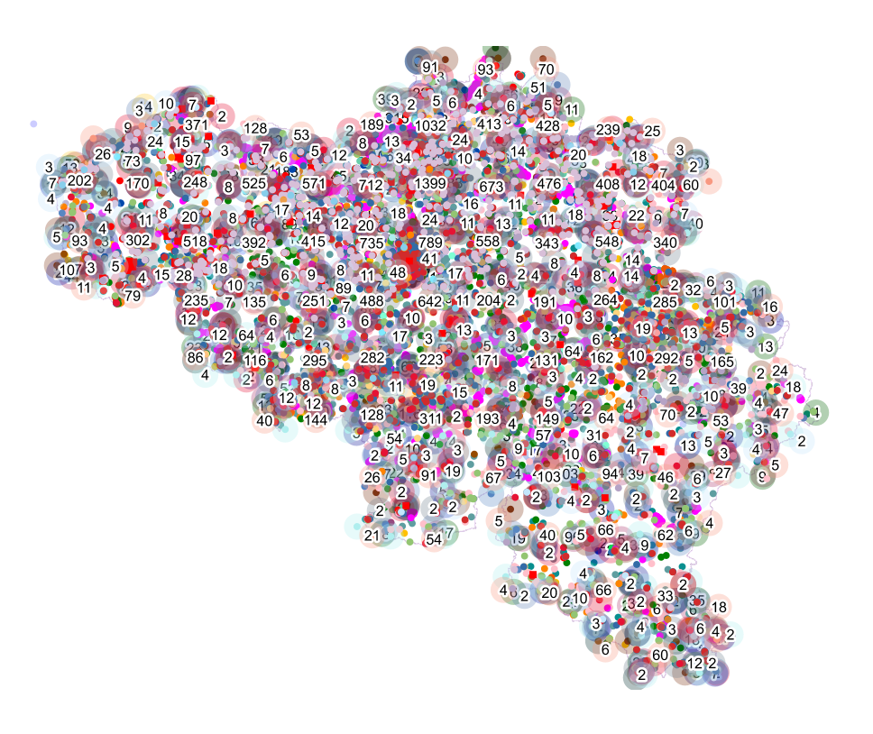
This dataset contains a set of Points Of Interest (POI) indicating the location of places of interest in Belgium, collected by NGI. The dataset consists of 97 POI types grouped into 6 classes (natural elements, cult elements, patrimonial elements, elements of general interest, infrastructures, economy). POI types that have a link with the NGI topographic reference data are systematically monitored to ensure consistency between these data. But for other POI types, there is no guarantee of completeness and correctness. These are updated ad hoc when an error or incompleteness is noticed.
Simple
- Date (Creation)
- 2023-09-01
- Date (Revision)
- 2025-04-03
- Citation identifier
- BE.NGI-IGN / 0a9bcf6b-3fa6-4590-b1d8-8058280279d5
- Status
- Completed
- Point of contact
-
Organisation name Individual name Electronic mail address Role National Geographic Institute
Bert Van Mele
Custodian
- Maintenance and update frequency
- Quarterly
-
Belgian Federal Thesaurus
- GEMET - Concept themes, version 4.01
-
- telecommunications
- tree
- civilian protection
- fire service
- cultural facility
- zoological garden
- health facility
- museum
- police
- educational institution
- public domain
- waste disposal
- lighting
- rail traffic
- non-residential building
- brewing industry
- solar power station
- slag
- cooling tower
- windmill
- water mill
- tunnel
- training centre
- station
- sports facility
- sluice
- point
- Keywords
-
-
POI
-
HVD_cat_land use, HVD_cat_buidings
-
- Use constraints
- Other restrictions
- Other constraints
- https://creativecommons.org/licenses/by/4.0/
- Access constraints
- Other restrictions
- Other constraints
- No limitations on public access
- Use limitation
- https://creativecommons.org/licenses/by/4.0/
- Spatial representation type
- Vector
- Denominator
- 10000
- Language
- Deutsch
- Language
- Français
- Language
- Nederlands; Vlaams
- Character set
- 8859 Part 15
- Topic category
-
- Location
- Description
-
Belgium
))
- Distribution format
-
Name Version GeoPackage Esri Shapefile
Digital transfer options
- OnLine resource
-
Protocol Linkage Name WWW:DOWNLOAD-1.0-http--download
https://ac.ngi.be/remoteclient-open/ngi-standard-open/Vectordata/POI/POI-All/0a9bcf6b-3fa6-4590-b1d8-8058280279d5_geopackage+sqlite3_3812.zip
Digital transfer options
- OnLine resource
-
Protocol Linkage Name WWW:DOWNLOAD-1.0-http--download
https://ac.ngi.be/remoteclient-open/ngi-standard-open/Vectordata/POI/POI-All/0a9bcf6b-3fa6-4590-b1d8-8058280279d5_geopackage+sqlite3_4326.zip
Digital transfer options
- OnLine resource
-
Protocol Linkage Name WWW:DOWNLOAD-1.0-http--download
https://ac.ngi.be/remoteclient-open/ngi-standard-open/Vectordata/POI/POI-All/0a9bcf6b-3fa6-4590-b1d8-8058280279d5_x-shapefile_4326.zip
Digital transfer options
- OnLine resource
-
Protocol Linkage Name WWW:DOWNLOAD-1.0-http--download
https://ac.ngi.be/remoteclient-open/ngi-standard-open/Vectordata/POI/POI-All/0a9bcf6b-3fa6-4590-b1d8-8058280279d5_x-shapefile_3812.zip
Digital transfer options
- OnLine resource
- Hierarchy level
- Dataset
Domain consistency
- Name of measure
-
INSPIRE Conformity
Conformance result
- Date (Publication)
- 2010-12-08
- Explanation
-
The dataset’s compliance with the technical requirements as defined by the Commission Regulation (EU) No 1089/2010 of 23 November 2010 has not been checked
- Statement
-
The POI dataset of the NGI was originally constructed as an auxiliary database for assigning appropriate attributes to NGI’s topographic reference data. Various sources were consulted. After checking and correcting the source data, additional POIs were added via aerial photographs or terrain observations.
Metadata
- File identifier
- 0a9bcf6b-3fa6-4590-b1d8-8058280279d5 XML
- Metadata language
- English
- Character set
- 8859 Part 15
- Hierarchy level
- Dataset
- Date stamp
- 2026-02-03T13:48:27
- Metadata standard name
-
ISO 19115:2003/19139
- Metadata standard version
-
1.0
- Metadata author
-
Organisation name Individual name Electronic mail address Role National Geographic Institute
Floor Van Damme
Point of contact
- Other language
-
Language Character encoding French UTF8 Dutch; Flemish UTF8 German UTF8 English UTF8