geo.be Metadata Catalog
Belgian Lightning Location System (BELLS)
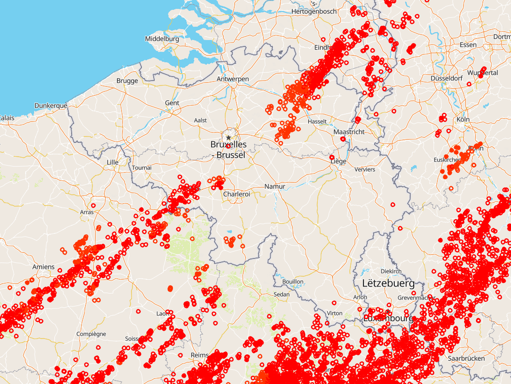
Total lightning observations, i.e., cloud-to-ground (CG) strokes and intra/inter-cloud (IC) pulses, in Belgium. BELLS data is given in Universal Time! (local time winter = UT +1; local time summer = UT + 2). Each record contains following fields:
1. Network type, 0 = LF, 1 = VHF-TOA, 2 = VHF-ITF, 3 = VLF
2. Year, 1970 to 2032.
3. Month, with January as 1 and December as 12.
4. Day of the month, 1 to 31.
5. Hour, 0 to 23.
6. Minute, 0 to 59.
7. Second, 0 to 60.
8. Nanosecond, 0 to 999999999.
9. Latitude of the calculated location in decimal degrees, to 4 decimal places, -90.0 to 90.0.
10. Longitude of the calculated location in decimal degrees, to 4 decimal places, -180.0 to 180.0.
11. Altitude in meters, -4950 to +60535. This field will be 0 if the altitude is not provided in the lightning data.
12. The altitude uncertainty in meters. This field will be 0 if the altitude uncertainty is not provided in the lightning data.
13. Estimated peak current in kiloamps, -9999 to 9999.
14. VHF Range normalized power, -9999.0 to 9999.0
15. Multiplicity for flash data (1 to 99) or 0 for strokes.
16. Cloud pulse count for the lightning record. This field will be -1 if the lightning did not contain the cloud pulse count attribute.
17. Number of sensors participating in the solution, 2 to 99.
18. Degrees of freedom when optimizing location, 0 to 99.
19. The error ellipse angle as a clockwise bearing from 0 degrees north, 0 to 180.0 degrees
20. The error ellipse semi-major axis length in kilometers, 0 to 50.0km.
21. The error ellipse semi-minor axis length in kilometers, 0 to 50.0km.
22. Chi-squared value from location optimization, 0 to 999.99
23. Rise time of the waveform in microseconds, 0 to 99.9
24. Peak-to-zero time of the waveform in microseconds, 0 to 999.9
25. Maximum rate-of-rise of the waveform in kA/usec (will be a negative rate if discharge is negative), -999.9 to 999.9
26. Cloud indicator, 1 if Cloud-to-cloud discharge, 0 for Cloud-to-ground
27. Angle indicator, 1 if sensor angle data used to compute position, 0 otherwise
28. Signal indicator, 1 if sensor signal data used to compute position, 0 otherwise
29. Timing indicator, 1 if sensor timing data used to compute position, 0 otherwise
30. Flash ID, a unique integer value identifying the flash grouping a stroke belongs to or 0 if not set.
This product is not publically available yet.
Simple
- Date (Revision)
- 2025-10-13
- Citation identifier
- RMI-be / lightning
- Status
- On going
- Point of contact
-
Organisation name Individual name Electronic mail address Role Royal Meteorological Institute of Belgium
Point of contact Royal Meteorological Institute of Belgium
Owner
-
GEMET - INSPIRE themes, version 1.0
-
-
Atmospheric conditions
-
- Keywords
-
-
federal government
-
observation
-
lightning
-
-
Spatial scope
- Access constraints
- Other restrictions
- Other constraints
- No limitations on public access
- Use constraints
- Other restrictions
- Classification
- Unclassified
- Spatial representation type
- Vector
- Language
- English
- Topic category
-
- Climatology, meteorology, atmosphere
))
- Begin date
- 1998-01-01T00:00:00
- Unique resource identifier
- EPSG:4258
- Distribution format
-
Name Version Text/plain
1.0
Digital transfer options
- OnLine resource
-
Protocol Linkage Name WWW:LINK-1.0-http--link
https://opendata.meteo.be
- Hierarchy level
- Dataset
- Other
-
dataset
Domain consistency
- Name of measure
-
INSPIRE Conformity
Conformance result
- Title
-
Commission Regulation (EU) No 1089/2010 of 23 November 2010 implementing Directive 2007/2/EC of the European Parliament and of the Council as regards interoperability of spatial data sets and services
- Date (Publication)
- 2010-12-08
- Explanation
-
See the referenced specification
- Pass
- No
- Statement
-
BELLS is a low-frequency ground-based lightning network. The lightning sensors and central processor are based on Vaisala technology. Only lightning records that fulfill certain quality criteria, e.g., length of the semi-major axis, minimum number of sensors participating, are included.
Metadata
- File identifier
- RMI_DATASET_LIGHTNING XML
- Metadata language
- English
- Hierarchy level
- Dataset
- Date stamp
- 2025-10-13
- Metadata author
-
Organisation name Individual name Electronic mail address Role Royal Meteorological Institute of Belgium
Point of contact
- Other language
-
Language Character encoding French UTF8 Dutch; Flemish UTF8 German UTF8