geo.be Metadata Catalog
Hydro - Physical Waters INSPIRE
The entities included in the dataset represent the physical network in the sense of the Inspire European directive. The dataset comprises several classes and is in accordance with the INSPIRE specifications.
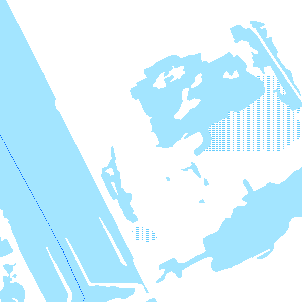
The Wetland class represents poorly drained or periodically flooded portions of land, the soil of which is saturated with water but where vegetation is nevertheless able to develop.
The StandingWater class represents flooded areas that are, nevertheless, completely surrounded by land.
Simple
- Date (Revision)
- 2017-03-16
- Citation identifier
- BE.NGI-IGN / 01d4aeaf-1302-47a7-83c0-4fd0820b1427
- Status
- Completed
- Point of contact
-
Organisation name Individual name Electronic mail address Role National Geographic Institute
Annie Royen
Custodian
- Maintenance and update frequency
- Quarterly
- Keywords
-
-
HVD_cat_hydrography
-
- Use limitation
- https://creativecommons.org/licenses/by/4.0/
- Access constraints
- Other restrictions
- Other constraints
- No limitations on public access
- Use constraints
- Other restrictions
- Other constraints
- https://creativecommons.org/licenses/by/4.0/
- Spatial representation type
- Vector
- Denominator
- 10000
- Language
- Nederlands; Vlaams
- Language
- Français
- Character set
- 8859 Part 15
- Topic category
-
- Inland waters
- Description
-
Belgium
))
- Unique resource identifier
- EPSG:3812
- Codespace
-
EPSG
- Distribution format
-
Name Version GML 3.2.1
Digital transfer options
- OnLine resource
-
Protocol Linkage Name OGC:WMS https://data.geo.be/ws/inspire_annex1/wms?request=getcapabilities&service=wms INSPIRE WMS
Digital transfer options
- OnLine resource
-
Protocol Linkage Name WWW:DOWNLOAD-1.0-http--download
https://ac.ngi.be/remoteclient-open/ngi-standard-open/Vectordata/INSPIRE/HydrographyPhysicalNetwork_gml_L08.zip
Digital transfer options
- Hierarchy level
- Dataset
Domain consistency
- Name of measure
-
INSPIRE Conformity
Conformance result
- Date (Publication)
- 2010-12-08
- Explanation
-
The dataset described fills the technical requirements sustaining the interoperability of data sets and services, as stipulated in the Commission Regulation (EU) No 1089/2010 of 23 November 2010
- Pass
- Yes
- Statement
-
The data have been collected in two different ways: on the one hand, by field survey, writing down the attribute data on mat-pale photographs, followed by the photogrammetric stereo restitution of the geometry in a CAD-file (with Lambert72 xyz-coordinates) and finally the topological cleaning up and the import of the attribute data in a 2D-database. On the other hand, by photogrammetric stereo restitution of the geometry in a CAD-file (with Lambert72 xyz-coordinates), followed by the import (on-site) of the attribute data in the CAD-files and finally the topological cleaning up in a 2D-database.During the dataloading into the new ITGI-model, the contents of the 2D-database have been mapped and converted into a database with Lambert2008-coordinates. The z-coordinate was recovered from the photogrammetric restitution's CAD-files or calculated on the basis of the DTM.
Metadata
- File identifier
- 01d4aeaf-1302-47a7-83c0-4fd0820b1427 XML
- Metadata language
- English
- Character set
- UTF8
- Parent identifier
-
9dbefb96-806f-477d-98ed-604c2a695b5f
9dbefb96-806f-477d-98ed-604c2a695b5f
- Hierarchy level
- Dataset
- Date stamp
- 2026-09-16T16:29:03
- Metadata standard name
-
ISO 19115:2003/19139
- Metadata standard version
-
1.0
- Metadata author
-
Organisation name Individual name Electronic mail address Role National Geographic Institute
Floor Van Damme
Point of contact
- Other language
-
Language Character encoding French Dutch; Flemish German English UTF8