 geo.be Metadata Catalog
2014
Type of resources
Available actions
Topics
INSPIRE themes
federalThemes
Keywords
Contact for the resource
Provided by
Years
Formats
Representation types
Update frequencies
status
Scale
-
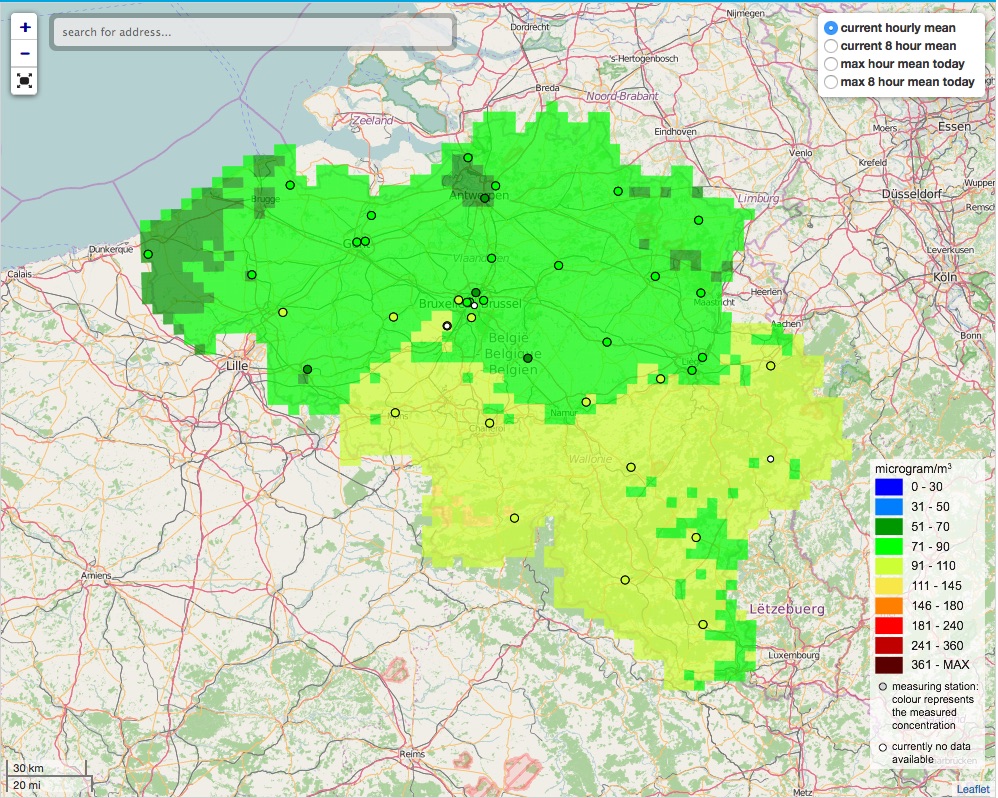
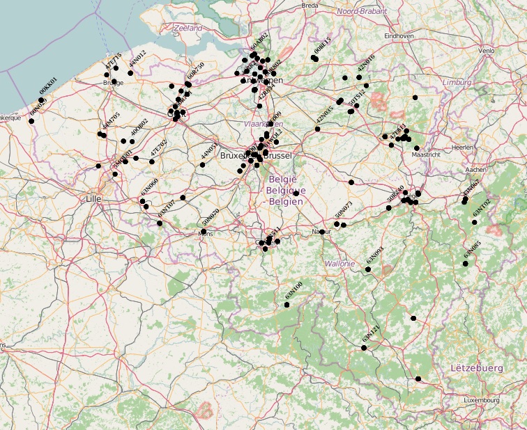
The air quality monitoring networks in Belgium are used for the assessment of air quality under the air quality directives (2008/50/EC & 2004/107/EC).
-
The air quality monitoring networks in Belgium are used for the assessment of air quality under the air quality directives (2008/50/EC & 2004/107/EC).
-
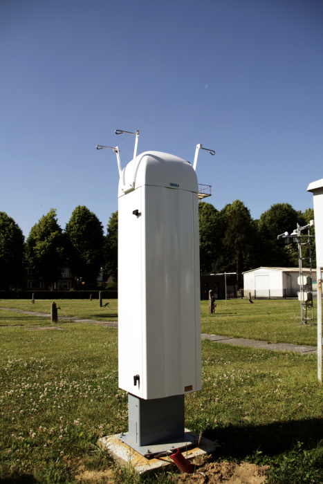
The ceilometer CL51 employs a pulsed diode laser LIDAR technology, where short, powerful laser pulses are sent out in a vertical or near-vertical direction. The reflection of light (backscatter) caused by clouds, precipitation or other obscuration is analysed and used to determine the cloud base height, the cloud layer height and the amount of clouds (in octas) in different layers.
-
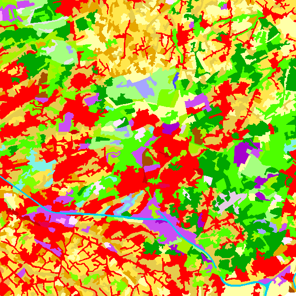
The data set contains a seamless polygonal layer representing the land cover in Belgium for the year 2006 and the year 2012. The polygons are spread over 32 classes from the CORINE Land Cover legend which are present un Belgium. The minimum map unit is 25 ha. The conceptual scale is 1:100 000. The data set also contains a polygon layer showing changes of more than 5 ha in the land cover between 2006 and 2012.
-

The dataset shows in the form of polygons the sand and gravel extraction sites in the Belgian marine areas as defined by the successive marine spatial plans. A 2014 version illustrates the 2014-2020 plan while the 2020 version illustrates the 2020-2026 plan.