 geo.be Metadata Catalog
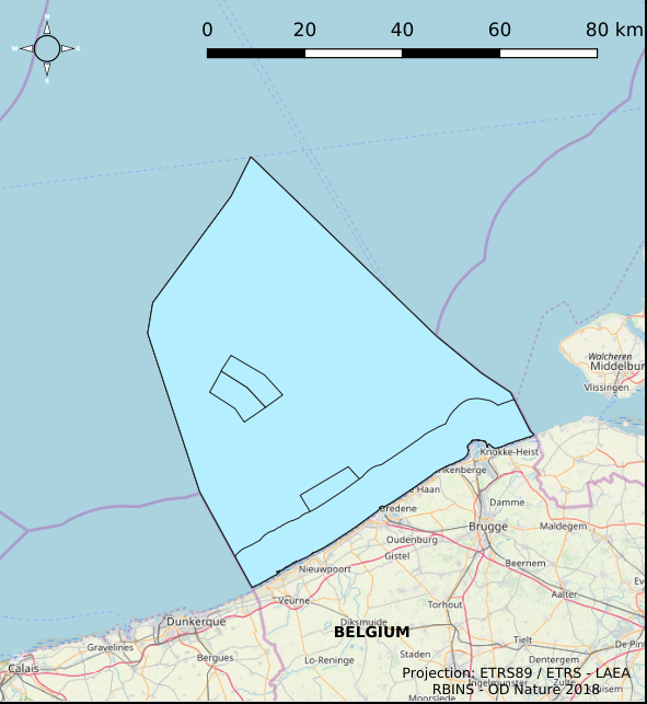
Oceans
Type of resources
Topics
INSPIRE themes
Keywords
Contact for the resource
Provided by
Years
Formats
Representation types
-
This dataset represents main data about the cores of Belgian boreholes that are stored by the Royal Belgian Institute of Natural Sciences. Data is distributed as shapefile with multiple meta-infomations such as unique borehole reference, depth, location, lithology and a link to access the core and lithological descriptions.
-

This dataset is part of the 2018 Belgian submission for the Marine Strategy Framework Directive (MSFD) linked to descriptor 8, criterion 1. This dataset contains the contaminant concentrations measured in sediments at 10 monitoring stations in the Belgian part of the North Sea between 2011 and 2015. 88 parameters are measured in the upper part of the sea bottom by a Van Veen grab sampler. The contaminants are analyzed on the fraction < 63 µm. PCBs and heavy metals are analyzed by ILVO (and CODA). PBDEs, PAHs and organotin compounds are analysed by KBIN-OD Nature, PAHs and organotin based on an accredited method (ISO/IEC 17025).
-
This dataset is part of the Belgian submission for the 2018 Marine Strategic Framework Directive (MSFD) and reports on descriptor 1, criterion 6. This dataset describes the soft benthos analysis performed in the Belgian part of the North Sea between 2010 and 2016. Information on the location, date and procedure used for the sediment sampling is povided as well as the description of the species found in the samples. Based on this dataset, the Belgian MSFD reporting concluded that the benthic habitat quality is clearly lower in areas where a certain activity interferes with the environment in an intensive way.
-
The Royal Decree of 22 May 2019 establishing a marine spatial plan defines 1 radar tower: Radar Oostdyck (Art. 21§3). Please refer to the Belgian official gazette (\"Moniteur belge/Belgisch Staatsblad\") for official reference information.
-

This dataset represents the exact location of active telecommunication cables (verified in 2010) installed in the Belgian Part of the North Sea.
-

The Royal Decree of 22 May 2019 establishing a marine spatial plan defines 20 shipping and ports zones: Shipping regular regime (Art. 10§1), Northbound traffic flow starting at separation line 'Noordhinder Sud' (Art. 10§2.1°), Separation zone 'Noordhinder Sud' (Art. 10§2.1°), Precaution zone 'Near Thornton and Blighbank ' (Art. 10§2.10°), Northbound traffic flow starting at separation zone 'Off Noordhinder' (Art. 10§2.2°), Separation zone 'Off Noordhinder' (Art. 10§2.2°), Southbound traffic flow starting at separation line 'Off Noordhinder' (Art. 10§2.2°), Precaution zone 'Noordhinder Jonction' (Art. 10§2.3°), Eastbound traffic flow starting at separation line 'At West Hinder' (Art. 10§2.4°), Eastbound traffic flow starting at separation zone 'At West Hinder' (Art. 10§2.4°), Precaution zone 'At West Hinder ' (Art. 10§2.4°), Separation zone 'At West Hinder' (Art. 10§2.4°), Westbound traffic flow starting at separation line 'At West Hinder' (Art. 10§2.4°), Area to be Avoided 'At West Hinder' (Art. 10§2.6°), Deep water route 'Westerschelde approach' (Art. 10§2.7°), Border line 1 of two-way shipping lane 'Westpit' (Art. 10§2.8°), Border line 2 of two-way shipping lane 'Westpit' (Art. 10§2.8°), Precaution zone 'At Gootebank' (Art. 10§2.9°), Anchoring zone 'Oostdyck' (Art. 10§3.1°), Anchoring zone 'Westhinder' (Art. 10§3.2°). It replaces the 2014 Marine Spatial Plan, which is included for completeness. The Royal Decree of 20 March 2014 establishing a marine spatial plan defines in its Art. 9, nine zones with regards to shipping and ports: seven shipping zones (Shipping regular regime, Art. 9 § 1; Shipping route Northhinder South, Art. 9 § 2.1°; Shipping route Northhinder junction, Art. 9 § 2.2°; Shipping route Westhinder, Art. 9 § 2.3°; Shipping route Westhinder precautionary area, Art. 9 § 2.4°; Shipping route Westhinder area to be avoided, Art. 9 § 2.5°; Deep water shipping route Western Scheldt approach, Art. 9 § 2.6°) and two anchorage places (Anchorage place 'Oostdyck', Art. 9 § 4.1° and Anchorage place 'Westhinder', Art. 9 § 4.2°). These zones are made available digitally in the resource described by this metadata document. Please refer to the Belgian official gazette (\"Moniteur belge/Belgisch Staatsblad\") for official reference information.
-

The Royal Decree of 22 May 2019 establishing a marine spatial plan defines 11 military use and storage sites for war munition zones: Exercise area for sweeping mines (Buiten Ratel) (Art. 17§1), Exercise area for sweeping mines - NB-01 (Westhinder) (Art. 17§1), Exercise area for sweeping mines - NBH-10 (Wenduine) (Art. 17§1), Exercise area for sweeping mines - QZR 040 (Art. 17§1), Munition destruction area (Art. 17§2), Area for shooting exercises on floating objects (Art. 17§3), Area for exercises in shallow waters (Art. 17§4), Area for shooting exercises from land - big sector (Art. 17§5), Area for shooting exercises from land - medium sector (Art. 17§5), Area for shooting exercises from land - small sector (Art. 17§5), Storage site for war munition Paardenmarkt (Art. 18§1). It replaces the 2014 Marine Spatial Plan, which is included for completeness. The Royal Decree of 20 March 2014 establishing a marine spatial plan defines in its Art. 13. and Art. 14., resp. nine zones for military use and one storage site for war munition: three zones for shooting exercises from land direction sea (Art 13. § 1 small sector, Art 13. § 1 medium sector, Art 13. § 1 large sector), four exercise areas for sweeping mines (Art 13. § 3, Exercise area 1 for sweeping mines, Art 13. § 5, Exercise area 2 for sweeping mines, Art 13. § 9, Exercise area 3 for sweeping mines, Art 13. § 13, Exercise area 4 for sweeping mines), one area for shooting exercises on floating objects (Art 13. § 7), one area for defusing mines (Art 13. § 11) and one zone to safeguard the closed storage site for war munition \"Paardenmarkt\" (Art. 14. § 1). These zones are made available digitally in the resource described by this metadata document. Please refer to the Belgian official gazette (\"Moniteur belge/Belgisch Staatsblad\") for official reference information.
-
This dataset is part of the 2018 Belgian submission for the Marine Strategy Framework Directive (MSFD) linked to descriptor 7, criterion 1. This dataset describes the impact of an offshore windmills farm on the hydrodynamics in the Belgian part of the North Sea (BPNS). Originally, it is a NetCDF file with the results of the reference simulation made with the COHERENS (COupled Hydrodynamical Ecological model for REgioNal Shelf seas) hydrodynamic model only forced by tides (no wind effect). Model resolution : ~ 12.5m. It contains both the reference situation which is a simulation without any windmill and the modeling result of the influence by the windmills on the hydrodynamic in the BPNS. The dataset contains the results on the most inner nested grid level for one reference spring-neap cycle: - hourly sea surface elevation - hourly bottom shear stress - hourly 3D horizontal velocity components (u,v) - hourly 3D eddy viscosity - time-averaged bottom shear stress over the reference spring-neap cycle - percentile 90 of the bottom shear stress for the reference spring-neap cycle - percentile 90 of the specific kinetic energy at the sea bed - accumulated time during which sedimentation processes are dominant - accumulated time during which re-suspension processes are dominant.
-
The Royal Decree of 22 May 2019 establishing a marine spatial plan defines 7 fishery management zones: Professional fisheries (Art. 13), Passive fisheries area (Noordhinder Noord) (Art. 14§4), Passive fisheries area (Noordhinder Zuid) (Art. 14§4), Passive fisheries (Fairybank) (Art. 14§4), Search area 1 for fisheries techniques (Art. 6§1), Search area 2 for fisheries techniques (Art. 6§1), Search area 3 for fisheries techniques (Art. 6§1). It replaces the 2014 Marine Spatial Plan, which is included for completeness. The Royal Decree of 20 March 2014 establishing a marine spatial plan defines in its Art. 6, six fisheries management areas: Regular regime, Art. 6 § 1; Fisheries management area 1, Art. 6 § 1.1°; Fisheries management area 2, Art. 6 § 1.2°; Fisheries management area 3, Art. 6 § 1.3°; Fisheries management area 4, Art. 6 § 1.4°; Fisheries management area 5, Art. 6 § 3. These zones are made available digitally in the resource described by this metadata document. Please refer to the Belgian official gazette (\"Moniteur belge/Belgisch Staatsblad\") for official reference information.
-
This dataset is part of the 2018 Belgian submission for the Marine Strategy Framework Directive (MSFD) linked to descriptor 6, criterion 1. This dataset describes and maps the the physical loss of the seabed in the Belgian part of the North Sea (BPNS) in the period 2011-2016. The dataset combines the different human activities responsible for a loss of seabed, including wrecks, measuring piles and radar stations, pipelines, power and telecommunication cables with their rock dump, and wind farms. The area lost is mapped and quantified per year, per activity and per benthic broad habitat.